

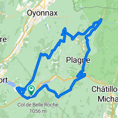
Nantua - Monts de l'Ain
A cycling route starting in Nantua, Auvergne-Rhône-Alpes, France.
Overview
About this route
- -:--
- Duration
- 89.8 km
- Distance
- 1,567 m
- Ascent
- 1,568 m
- Descent
- ---
- Avg. speed
- ---
- Max. altitude

Route quality
Waytypes & surfaces along the route
Waytypes
Road
63 km
(70 %)
Busy road
23.8 km
(27 %)
Surfaces
Paved
9.8 km
(11 %)
Unpaved
0.8 km
(<1 %)
Asphalt
9.8 km
(11 %)
Ground
0.8 km
(<1 %)
Undefined
79.2 km
(88 %)
Continue with Bikemap
Use, edit, or download this cycling route
You would like to ride Nantua - Monts de l'Ain or customize it for your own trip? Here is what you can do with this Bikemap route:
Free features
- Save this route as favorite or in collections
- Copy & plan your own version of this route
- Split it into stages to create a multi-day tour
- Sync your route with Garmin or Wahoo
Premium features
Free trial for 3 days, or one-time payment. More about Bikemap Premium.
- Navigate this route on iOS & Android
- Export a GPX / KML file of this route
- Create your custom printout (try it for free)
- Download this route for offline navigation
Discover more Premium features.
Get Bikemap PremiumFrom our community
Other popular routes starting in Nantua
 Lac Genin Loop
- Distance
- 57.2 km
- Ascent
- 1,246 m
- Descent
- 1,208 m
- Location
- Nantua, Auvergne-Rhône-Alpes, France
 Jura 8 Col Loop
- Distance
- 83.9 km
- Ascent
- 1,562 m
- Descent
- 1,561 m
- Location
- Nantua, Auvergne-Rhône-Alpes, France
 Jura Col Hunting via Trails
- Distance
- 63 km
- Ascent
- 1,280 m
- Descent
- 1,280 m
- Location
- Nantua, Auvergne-Rhône-Alpes, France
 2020-06-07 / Haut Bugey - Plateau du Retord
- Distance
- 56.7 km
- Ascent
- 3,182 m
- Descent
- 3,186 m
- Location
- Nantua, Auvergne-Rhône-Alpes, France
 circ 24 AIN
- Distance
- 85.8 km
- Ascent
- 1,377 m
- Descent
- 1,375 m
- Location
- Nantua, Auvergne-Rhône-Alpes, France
 De 311 Rue de la Gélinotte, Nantua à 297 Rue de la Gélinotte, Nantua
- Distance
- 15.3 km
- Ascent
- 57 m
- Descent
- 52 m
- Location
- Nantua, Auvergne-Rhône-Alpes, France
 Golet Hunting in the Juras
- Distance
- 47.6 km
- Ascent
- 922 m
- Descent
- 922 m
- Location
- Nantua, Auvergne-Rhône-Alpes, France
 Golets
- Distance
- 56.6 km
- Ascent
- 1,069 m
- Descent
- 1,072 m
- Location
- Nantua, Auvergne-Rhône-Alpes, France
Open it in the app