

Bierstraße - ehemaliger Braunkohletagebau
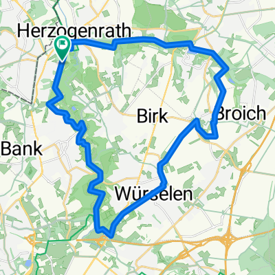
A cycling route starting in Herzogenrath, North Rhine-Westphalia, Germany.
Overview
About this route
Rundweg von Bierstraß über Noppenberg und Ruif zum ehemaligen Braunkohletagebau bzw. Mülldeponie der Stadt Herzogenrath zur St. Antonius.Kapelle. Nach kleiner Pause geht es zurück über den Hillenberg vorbei am H'rather Stausee.
- -:--
- Duration
- 8.1 km
- Distance
- 108 m
- Ascent
- 108 m
- Descent
- ---
- Avg. speed
- ---
- Avg. speed

Route quality
Waytypes & surfaces along the route
Waytypes
Quiet road
2.6 km
(32 %)
Path
2.2 km
(27 %)
Surfaces
Paved
2.8 km
(34 %)
Unpaved
3.3 km
(41 %)
Asphalt
2.2 km
(27 %)
Ground
1.6 km
(20 %)
Continue with Bikemap
Use, edit, or download this cycling route
You would like to ride Bierstraße - ehemaliger Braunkohletagebau or customize it for your own trip? Here is what you can do with this Bikemap route:
Free features
- Save this route as favorite or in collections
- Copy & plan your own version of this route
- Sync your route with Garmin or Wahoo
Premium features
Free trial for 3 days, or one-time payment. More about Bikemap Premium.
- Navigate this route on iOS & Android
- Export a GPX / KML file of this route
- Create your custom printout (try it for free)
- Download this route for offline navigation
Discover more Premium features.
Get Bikemap PremiumFrom our community
Other popular routes starting in Herzogenrath
 Airbase Rund
- Distance
- 39.4 km
- Ascent
- 140 m
- Descent
- 154 m
- Location
- Herzogenrath, North Rhine-Westphalia, Germany
 Rund um Merkstein mit Aufstieg
- Distance
- 14.7 km
- Ascent
- 180 m
- Descent
- 182 m
- Location
- Herzogenrath, North Rhine-Westphalia, Germany
 Wurmwanderroute Pley
- Distance
- 7.1 km
- Ascent
- 153 m
- Descent
- 152 m
- Location
- Herzogenrath, North Rhine-Westphalia, Germany
 AZAN Tour 4 Durch Den Norden Der Städteregion
- Distance
- 29.4 km
- Ascent
- 162 m
- Descent
- 163 m
- Location
- Herzogenrath, North Rhine-Westphalia, Germany
 Tolle Landschaftsroute CLONED FROM ROUTE 220895
- Distance
- 25.5 km
- Ascent
- 162 m
- Descent
- 162 m
- Location
- Herzogenrath, North Rhine-Westphalia, Germany
 Brunsummer Heide Rodebach
- Distance
- 56 km
- Ascent
- 197 m
- Descent
- 218 m
- Location
- Herzogenrath, North Rhine-Westphalia, Germany
 Rund um den See
- Distance
- 40 km
- Ascent
- 127 m
- Descent
- 103 m
- Location
- Herzogenrath, North Rhine-Westphalia, Germany
 An Wurm und Broichbach
- Distance
- 28.4 km
- Ascent
- 133 m
- Descent
- 111 m
- Location
- Herzogenrath, North Rhine-Westphalia, Germany
Open it in the app