

Biberstein Wasserschlösschen Bieberstein
A cycling route starting in Biberstein, Canton of Aargau, Switzerland.
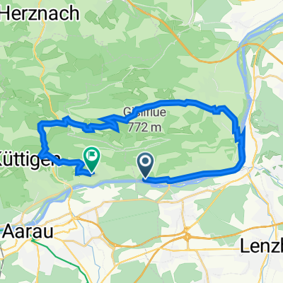
Overview
About this route
- -:--
- Duration
- 52.4 km
- Distance
- 472 m
- Ascent
- 476 m
- Descent
- ---
- Avg. speed
- ---
- Max. altitude

Route quality
Waytypes & surfaces along the route
Waytypes
Quiet road
13.2 km
(25 %)
Track
12.5 km
(24 %)
Surfaces
Paved
35 km
(67 %)
Unpaved
8.3 km
(16 %)
Asphalt
34.5 km
(66 %)
Gravel
8.2 km
(16 %)
Continue with Bikemap
Use, edit, or download this cycling route
You would like to ride Biberstein Wasserschlösschen Bieberstein or customize it for your own trip? Here is what you can do with this Bikemap route:
Free features
- Save this route as favorite or in collections
- Copy & plan your own version of this route
- Sync your route with Garmin or Wahoo
Premium features
Free trial for 3 days, or one-time payment. More about Bikemap Premium.
- Navigate this route on iOS & Android
- Export a GPX / KML file of this route
- Create your custom printout (try it for free)
- Download this route for offline navigation
Discover more Premium features.
Get Bikemap PremiumFrom our community
Other popular routes starting in Biberstein
 20160622_085117.gpx
- Distance
- 30.3 km
- Ascent
- 792 m
- Descent
- 790 m
- Location
- Biberstein, Canton of Aargau, Switzerland
 Kirchbergstrasse 2, Biberstein nach Kirchbergstrasse 10, Biberstein
- Distance
- 23.6 km
- Ascent
- 483 m
- Descent
- 484 m
- Location
- Biberstein, Canton of Aargau, Switzerland
 Biberstein - Kantonsmitte - Suhr - Biberstein
- Distance
- 16.9 km
- Ascent
- 101 m
- Descent
- 96 m
- Location
- Biberstein, Canton of Aargau, Switzerland
 Biberstein - Thalheim - Staffelegg - Biberstein
- Distance
- 21.2 km
- Ascent
- 476 m
- Descent
- 442 m
- Location
- Biberstein, Canton of Aargau, Switzerland
 20151115_102115.gpx
- Distance
- 56.4 km
- Ascent
- 748 m
- Descent
- 881 m
- Location
- Biberstein, Canton of Aargau, Switzerland
 Biberstein - Bally Park - Biberstein
- Distance
- 11.2 km
- Ascent
- 52 m
- Descent
- 80 m
- Location
- Biberstein, Canton of Aargau, Switzerland
 Biberstein Wasserschlösschen Bieberstein
- Distance
- 52.4 km
- Ascent
- 472 m
- Descent
- 476 m
- Location
- Biberstein, Canton of Aargau, Switzerland
 Moderate Route in Untersiggenthal
- Distance
- 24 km
- Ascent
- 114 m
- Descent
- 85 m
- Location
- Biberstein, Canton of Aargau, Switzerland
Open it in the app