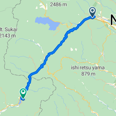
CJ20 奥日光~日光(2016)
A cycling route starting in Nikkō, Tochigi, Japan.
Overview
About this route
- -:--
- Duration
- 31.9 km
- Distance
- 87 m
- Ascent
- 981 m
- Descent
- ---
- Avg. speed
- ---
- Avg. speed
Route quality
Waytypes & surfaces along the route
Waytypes
Undefined
31.9 km
(100 %)
Surfaces
Undefined
31.9 km
(100 %)
Continue with Bikemap
Use, edit, or download this cycling route
You would like to ride CJ20 奥日光~日光(2016) or customize it for your own trip? Here is what you can do with this Bikemap route:
Free features
- Save this route as favorite or in collections
- Copy & plan your own version of this route
- Sync your route with Garmin or Wahoo
Premium features
Free trial for 3 days, or one-time payment. More about Bikemap Premium.
- Navigate this route on iOS & Android
- Export a GPX / KML file of this route
- Create your custom printout (try it for free)
- Download this route for offline navigation
Discover more Premium features.
Get Bikemap PremiumFrom our community
Other popular routes starting in Nikkō
- LoJ: Tohoku
- Distance
- 1,056.4 km
- Ascent
- 4,114 m
- Descent
- 4,662 m
- Location
- Nikkō, Tochigi, Japan
- Segment10
- Distance
- 192.5 km
- Ascent
- 1,089 m
- Descent
- 1,637 m
- Location
- Nikkō, Tochigi, Japan
- 2016Tour-NikkoYumoto-Nikko
- Distance
- 31.2 km
- Ascent
- 146 m
- Descent
- 1,054 m
- Location
- Nikkō, Tochigi, Japan
- Length of Japan, Tohoku
- Distance
- 1,060.1 km
- Ascent
- 5,419 m
- Descent
- 5,893 m
- Location
- Nikkō, Tochigi, Japan
- Nikko Trip
- Distance
- 108.2 km
- Ascent
- 1,848 m
- Descent
- 1,860 m
- Location
- Nikkō, Tochigi, Japan
- CJ20 奥日光~日光(2016)
- Distance
- 31.9 km
- Ascent
- 87 m
- Descent
- 981 m
- Location
- Nikkō, Tochigi, Japan
- 2017/4/1
- Distance
- 114.4 km
- Ascent
- 26 m
- Descent
- 543 m
- Location
- Nikkō, Tochigi, Japan
- わたらせ渓谷鐵道バイク&レール ver. 3.1
- Distance
- 52.9 km
- Ascent
- 1,003 m
- Descent
- 1,554 m
- Location
- Nikkō, Tochigi, Japan