Wörth-Oberwolkersdorf-Winzersdorf-Frauenbiburg-Teisbach-Wörth
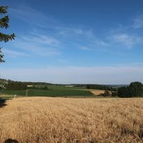
A cycling route starting in Wörth an der Isar, Bavaria, Germany.
Overview
About this route
Between Nöham and Winzersdorf, there is a stretch of gravel path!!
- -:--
- Duration
- 48.8 km
- Distance
- 408 m
- Ascent
- 409 m
- Descent
- ---
- Avg. speed
- ---
- Max. altitude
Route photos
Route quality
Waytypes & surfaces along the route
Waytypes
Quiet road
17.1 km
(35 %)
Path
17.1 km
(35 %)
Surfaces
Paved
41 km
(84 %)
Unpaved
1 km
(2 %)
Asphalt
41 km
(84 %)
Gravel
1 km
(2 %)
Undefined
6.8 km
(14 %)
Continue with Bikemap
Use, edit, or download this cycling route
You would like to ride Wörth-Oberwolkersdorf-Winzersdorf-Frauenbiburg-Teisbach-Wörth or customize it for your own trip? Here is what you can do with this Bikemap route:
Free features
- Save this route as favorite or in collections
- Copy & plan your own version of this route
- Sync your route with Garmin or Wahoo
Premium features
Free trial for 3 days, or one-time payment. More about Bikemap Premium.
- Navigate this route on iOS & Android
- Export a GPX / KML file of this route
- Create your custom printout (try it for free)
- Download this route for offline navigation
Discover more Premium features.
Get Bikemap PremiumFrom our community
Other popular routes starting in Wörth an der Isar
Wörth-Hohenthann-Rottenburg_Industriegebiet-Inkofen-Rohrberg-Ergoldsbach-Siegensdorf-Wörth- Distance
- 61.3 km
- Ascent
- 509 m
- Descent
- 509 m
- Location
- Wörth an der Isar, Bavaria, Germany
Wörth-Kronwieden-Rimbach-Ottending-Hofdorf-Weichshofen-Hüttenkofen-Ottering-Thürntenning-Weng-Postau-Wörth- Distance
- 53 km
- Ascent
- 332 m
- Descent
- 333 m
- Location
- Wörth an der Isar, Bavaria, Germany
Renner_Optimal_Wörth-Seemannshsn.-Oberspechtrain-Frontenhsn.-Obertrennbach-Seemannshsn.-Gangkofen-Aham-Wörth- Distance
- 76.2 km
- Ascent
- 745 m
- Descent
- 743 m
- Location
- Wörth an der Isar, Bavaria, Germany
Wörth-Oberwolkersdorf-Winzersdorf-Frauenbiburg-Teisbach-Wörth- Distance
- 48.8 km
- Ascent
- 408 m
- Descent
- 409 m
- Location
- Wörth an der Isar, Bavaria, Germany
Wörth-Mengkofen-Haindling-Geiselhöring-Niedersunzing-Wörth_2018- Distance
- 83.2 km
- Ascent
- 385 m
- Descent
- 388 m
- Location
- Wörth an der Isar, Bavaria, Germany
Wörth-Niederviehbach-Gummering-Loiching-Bergham-Teisbach-Oberteisbach-Maßendorf-Weigendorf-Süßbach-Schlott-Gummering-Wörth- Distance
- 27.9 km
- Ascent
- 292 m
- Descent
- 292 m
- Location
- Wörth an der Isar, Bavaria, Germany
Mit Marietta ins süße Leben- Distance
- 35.7 km
- Ascent
- 694 m
- Descent
- 694 m
- Location
- Wörth an der Isar, Bavaria, Germany
Wörth-Niederviehbach_Isarbrücke_Kronwieden-Loiching-Schlott-Süßbach-Kirchberg-Setzensack-Adlkofen-Frauenberg-Wolfsbach-Niederaichbach-Wörth- Distance
- 48.1 km
- Ascent
- 460 m
- Descent
- 460 m
- Location
- Wörth an der Isar, Bavaria, Germany
Open it in the app


