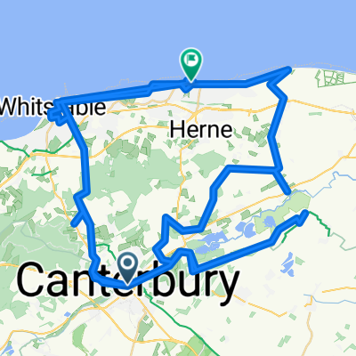
Canterbury to Deal NCR 1
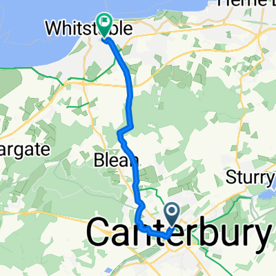
A cycling route starting in Canterbury, England, United Kingdom.
Overview
About this route
- -:--
- Duration
- 38 km
- Distance
- 132 m
- Ascent
- 136 m
- Descent
- ---
- Avg. speed
- ---
- Max. altitude
Route quality
Waytypes & surfaces along the route
Waytypes
Quiet road
25.5 km
(67 %)
Road
7.6 km
(20 %)
Surfaces
Paved
35.1 km
(92 %)
Unpaved
0.5 km
(1 %)
Asphalt
35.1 km
(92 %)
Ground
0.4 km
(1 %)
Continue with Bikemap
Use, edit, or download this cycling route
You would like to ride Canterbury to Deal NCR 1 or customize it for your own trip? Here is what you can do with this Bikemap route:
Free features
- Save this route as favorite or in collections
- Copy & plan your own version of this route
- Sync your route with Garmin or Wahoo
Premium features
Free trial for 3 days, or one-time payment. More about Bikemap Premium.
- Navigate this route on iOS & Android
- Export a GPX / KML file of this route
- Create your custom printout (try it for free)
- Download this route for offline navigation
Discover more Premium features.
Get Bikemap PremiumFrom our community
Other popular routes starting in Canterbury
- From Canterbury to Dover
- Distance
- 34.3 km
- Ascent
- 347 m
- Descent
- 352 m
- Location
- Canterbury, England, United Kingdom
- South Canterbury round 2
- Distance
- 34.2 km
- Ascent
- 267 m
- Descent
- 267 m
- Location
- Canterbury, England, United Kingdom
- Recovered Route
- Distance
- 6.8 km
- Ascent
- 287 m
- Descent
- 286 m
- Location
- Canterbury, England, United Kingdom
- Canterbury Chartham
- Distance
- 16 km
- Ascent
- 146 m
- Descent
- 143 m
- Location
- Canterbury, England, United Kingdom
- Coastal route
- Distance
- 92.7 km
- Ascent
- 288 m
- Descent
- 298 m
- Location
- Canterbury, England, United Kingdom
- From Canterbury to Ashford
- Distance
- 17.4 km
- Ascent
- 139 m
- Descent
- 116 m
- Location
- Canterbury, England, United Kingdom
- Sunday ride
- Distance
- 98 km
- Ascent
- 547 m
- Descent
- 547 m
- Location
- Canterbury, England, United Kingdom
- Bike20_Canterbury_London_rough
- Distance
- 135.4 km
- Ascent
- 402 m
- Descent
- 395 m
- Location
- Canterbury, England, United Kingdom
Open it in the app