18082019
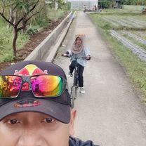
A cycling route starting in Purbalingga, Central Java, Indonesia.
Overview
About this route
- 2 h 2 min
- Duration
- 23 km
- Distance
- 258 m
- Ascent
- 253 m
- Descent
- 11.3 km/h
- Avg. speed
- ---
- Avg. speed
Route photos
Route quality
Waytypes & surfaces along the route
Waytypes
Quiet road
9.9 km
(43 %)
Busy road
8.2 km
(35 %)
Surfaces
Paved
5 km
(22 %)
Asphalt
5 km
(22 %)
Undefined
18 km
(78 %)
Continue with Bikemap
Use, edit, or download this cycling route
You would like to ride 18082019 or customize it for your own trip? Here is what you can do with this Bikemap route:
Free features
- Save this route as favorite or in collections
- Copy & plan your own version of this route
- Sync your route with Garmin or Wahoo
Premium features
Free trial for 3 days, or one-time payment. More about Bikemap Premium.
- Navigate this route on iOS & Android
- Export a GPX / KML file of this route
- Create your custom printout (try it for free)
- Download this route for offline navigation
Discover more Premium features.
Get Bikemap PremiumFrom our community
Other popular routes starting in Purbalingga
- Easy ride
- Distance
- 52.6 km
- Ascent
- 271 m
- Descent
- 296 m
- Location
- Purbalingga, Central Java, Indonesia
- Unnamed Road, Kutasari to Jalan Purbalingga - Klampok 142, Kecamatan Purbalingga
- Distance
- 5.8 km
- Ascent
- 34 m
- Descent
- 87 m
- Location
- Purbalingga, Central Java, Indonesia
- Jalan Letnan Yusuf 2, Kecamatan Padamara to Jalan Letnan Yusuf 2, Kecamatan Padamara
- Distance
- 10.8 km
- Ascent
- 73 m
- Descent
- 68 m
- Location
- Purbalingga, Central Java, Indonesia
- Jalan Raya Jompo, Kecamatan Kalimanah to Jalan Raya Muntang, Kecamatan Kemangkon
- Distance
- 18.1 km
- Ascent
- 113 m
- Descent
- 126 m
- Location
- Purbalingga, Central Java, Indonesia
- Minggu 16 juni 2019
- Distance
- 24 km
- Ascent
- 276 m
- Descent
- 274 m
- Location
- Purbalingga, Central Java, Indonesia
- perja - dieng
- Distance
- 89 km
- Ascent
- 2,055 m
- Descent
- 48 m
- Location
- Purbalingga, Central Java, Indonesia
- 18082019
- Distance
- 23 km
- Ascent
- 258 m
- Descent
- 253 m
- Location
- Purbalingga, Central Java, Indonesia
- Jalan Raya Bojong, Kecamatan Kemangkon to Jl. Restu, Kecamatan Purbalingga
- Distance
- 1.8 km
- Ascent
- 0 m
- Descent
- 25 m
- Location
- Purbalingga, Central Java, Indonesia
Open it in the app