

Bottecchia Road + Laghi
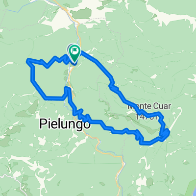
A cycling route starting in Anduins, Friuli Venezia Giulia, Italy.
Overview
About this route
- 1 h 21 min
- Duration
- 20.7 km
- Distance
- 163 m
- Ascent
- 144 m
- Descent
- 15.3 km/h
- Avg. speed
- ---
- Max. altitude

Route photos

Route quality
Waytypes & surfaces along the route
Waytypes
Road
8.9 km
(43 %)
Track
1.2 km
(6 %)
Surfaces
Paved
8.1 km
(39 %)
Unpaved
0.2 km
(1 %)
Asphalt
8.1 km
(39 %)
Gravel
0.2 km
(1 %)
Undefined
12.4 km
(60 %)
Continue with Bikemap
Use, edit, or download this cycling route
You would like to ride Bottecchia Road + Laghi or customize it for your own trip? Here is what you can do with this Bikemap route:
Free features
- Save this route as favorite or in collections
- Copy & plan your own version of this route
- Sync your route with Garmin or Wahoo
Premium features
Free trial for 3 days, or one-time payment. More about Bikemap Premium.
- Navigate this route on iOS & Android
- Export a GPX / KML file of this route
- Create your custom printout (try it for free)
- Download this route for offline navigation
Discover more Premium features.
Get Bikemap PremiumFrom our community
Other popular routes starting in Anduins
 Anduins - Celante - Manazzons
- Distance
- 17.3 km
- Ascent
- 454 m
- Descent
- 456 m
- Location
- Anduins, Friuli Venezia Giulia, Italy
 Knorr Giro túra - Péntek Piancavallora
- Distance
- 61.7 km
- Ascent
- 1,246 m
- Descent
- 278 m
- Location
- Anduins, Friuli Venezia Giulia, Italy
 monte prat
- Distance
- 27.4 km
- Ascent
- 755 m
- Descent
- 755 m
- Location
- Anduins, Friuli Venezia Giulia, Italy
 Bottecchia Road + Laghi
- Distance
- 20.7 km
- Ascent
- 163 m
- Descent
- 144 m
- Location
- Anduins, Friuli Venezia Giulia, Italy
 Knorr Giro túra - Csütörtök Sella Chianzutan oda-vissza
- Distance
- 46.7 km
- Ascent
- 798 m
- Descent
- 798 m
- Location
- Anduins, Friuli Venezia Giulia, Italy
 prova san francesco
- Distance
- 36.3 km
- Ascent
- 1,539 m
- Descent
- 1,529 m
- Location
- Anduins, Friuli Venezia Giulia, Italy
 Castello Ceconi da Anduins
- Distance
- 20.6 km
- Ascent
- 410 m
- Descent
- 410 m
- Location
- Anduins, Friuli Venezia Giulia, Italy
 Monte Prat
- Distance
- 24.5 km
- Ascent
- 659 m
- Descent
- 654 m
- Location
- Anduins, Friuli Venezia Giulia, Italy
Open it in the app