Mettlen Tour
A cycling route starting in Luthern, Canton of Lucerne, Switzerland.
Overview
About this route
<span style='font-size: x-large;'><span style='font-size: 24px;'><span style='text-decoration: underline;'><span style='font-family: Arial, Helvetica, sans-serif; font-weight: normal; -webkit-text-decorations-in-effect: none; font-size: 11px;'>zum Bikehotel > www.kroneluthern.ch</span></span></span></span>
This tour can also be referred to as Napf round trip.
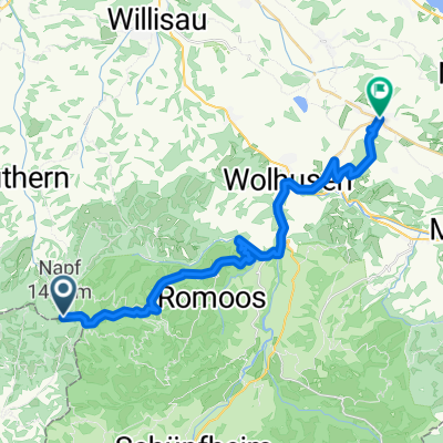
The tour begins with a long, increasingly steep ascent from Luthern to Bodenenzi and up to Enzisattel. After a long descent through landscapes familiar from Gotthelf films, you arrive at Fankhaus. Now the tour begins again – just in reverse and a valley further east. The route follows the watercourse of the Fankhausbach to Mettlenalp and then up to the highest point of the tour – Stächelegg.
Enjoy the magnificent view of the Alpine world and loosen your muscles, as another dreamy descent begins, peppered with great single trails. The descent leads over Hapfigchnubel, from the shady side of the Enzi forest to the sunny side, and from Mülibühl via Brüschknubel to Luthermattegg. From there, descend to the finish in Luthern -<span style='mso-spacerun: yes;'> </span>Dorf.
- -:--
- Duration
- 32.5 km
- Distance
- 880 m
- Ascent
- 875 m
- Descent
- ---
- Avg. speed
- ---
- Max. altitude
Route quality
Waytypes & surfaces along the route
Waytypes
Track
20.5 km
(63 %)
Quiet road
7.8 km
(24 %)
Surfaces
Paved
10.4 km
(32 %)
Unpaved
7.5 km
(23 %)
Paved (undefined)
8.4 km
(26 %)
Gravel
5.5 km
(17 %)
Continue with Bikemap
Use, edit, or download this cycling route
You would like to ride Mettlen Tour or customize it for your own trip? Here is what you can do with this Bikemap route:
Free features
- Save this route as favorite or in collections
- Copy & plan your own version of this route
- Sync your route with Garmin or Wahoo
Premium features
Free trial for 3 days, or one-time payment. More about Bikemap Premium.
- Navigate this route on iOS & Android
- Export a GPX / KML file of this route
- Create your custom printout (try it for free)
- Download this route for offline navigation
Discover more Premium features.
Get Bikemap PremiumFrom our community
Other popular routes starting in Luthern
 Napf-Luzern
- Distance
- 39.8 km
- Ascent
- 199 m
- Descent
- 1,161 m
- Location
- Luthern, Canton of Lucerne, Switzerland
 Scheidegg Tour
- Distance
- 17.7 km
- Ascent
- 564 m
- Descent
- 559 m
- Location
- Luthern, Canton of Lucerne, Switzerland
 Napfrundfahrt
- Distance
- 107 km
- Ascent
- 897 m
- Descent
- 897 m
- Location
- Luthern, Canton of Lucerne, Switzerland
 Änzi Tour
- Distance
- 20.7 km
- Ascent
- 639 m
- Descent
- 636 m
- Location
- Luthern, Canton of Lucerne, Switzerland
 Heuberg-Schwarzenbach-Guggi-Heuberg
- Distance
- 2.2 km
- Ascent
- 157 m
- Descent
- 155 m
- Location
- Luthern, Canton of Lucerne, Switzerland
 Napf nach Wächtergass
- Distance
- 27.2 km
- Ascent
- 348 m
- Descent
- 1,152 m
- Location
- Luthern, Canton of Lucerne, Switzerland
 treff
treff- Distance
- 10.6 km
- Ascent
- 235 m
- Descent
- 190 m
- Location
- Luthern, Canton of Lucerne, Switzerland
 Fritzefluh Tour
- Distance
- 39.5 km
- Ascent
- 871 m
- Descent
- 868 m
- Location
- Luthern, Canton of Lucerne, Switzerland
Open it in the app

