

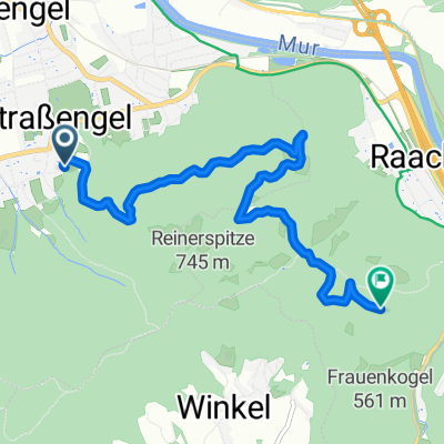
Strassengel - Ruine Gösting
A cycling route starting in Gratwein, Styria, Austria.
Overview
About this route
- 47 min
- Duration
- 6.1 km
- Distance
- 336 m
- Ascent
- 147 m
- Descent
- 7.7 km/h
- Avg. speed
- ---
- Max. altitude
Continue with Bikemap
Use, edit, or download this cycling route
You would like to ride Strassengel - Ruine Gösting or customize it for your own trip? Here is what you can do with this Bikemap route:
Free features
- Save this route as favorite or in collections
- Copy & plan your own version of this route
- Sync your route with Garmin or Wahoo
Premium features
Free trial for 3 days, or one-time payment. More about Bikemap Premium.
- Navigate this route on iOS & Android
- Export a GPX / KML file of this route
- Create your custom printout (try it for free)
- Download this route for offline navigation
Discover more Premium features.
Get Bikemap PremiumFrom our community
Other popular routes starting in Gratwein
 Rundkurs (Mariazell)
- Distance
- 339.4 km
- Ascent
- 3,257 m
- Descent
- 3,253 m
- Location
- Gratwein, Styria, Austria
 Judendorf GP
- Distance
- 17.3 km
- Ascent
- 287 m
- Descent
- 287 m
- Location
- Gratwein, Styria, Austria
 Reiner Straße 33, Gemeinde Gratwein nach Reiner Straße 33, Gemeinde Gratwein
- Distance
- 7.3 km
- Ascent
- 22 m
- Descent
- 31 m
- Location
- Gratwein, Styria, Austria
 8111 - frauenkogel - 8111
- Distance
- 11.2 km
- Ascent
- 371 m
- Descent
- 355 m
- Location
- Gratwein, Styria, Austria
 Strassengel - Ruine Gösting
- Distance
- 6.1 km
- Ascent
- 336 m
- Descent
- 147 m
- Location
- Gratwein, Styria, Austria
 Um den Schöckel
- Distance
- 54.9 km
- Ascent
- 1,085 m
- Descent
- 1,085 m
- Location
- Gratwein, Styria, Austria
 schöckel hin
- Distance
- 36 km
- Ascent
- 1,146 m
- Descent
- 107 m
- Location
- Gratwein, Styria, Austria
 Judendorfer Hausroute
- Distance
- 13.1 km
- Ascent
- 499 m
- Descent
- 496 m
- Location
- Gratwein, Styria, Austria
Open it in the app