


Elbe
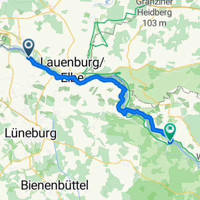
Elberadweg bei Lauenburg - hohes Elbufer
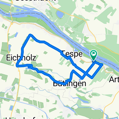
A cycling route starting in Tespe, Lower Saxony, Germany.
Overview
About this route
3
Interessante Waldstrecke zwischen dem CP Hohes Elbufer und Lauenburg
- -:--
- Duration
- 23.1 km
- Distance
- 190 m
- Ascent
- 179 m
- Descent
- ---
- Avg. speed
- ---
- Max. altitude
roadrunner858
created this 6 years ago
Part of
Elbe
3 stages
Route quality
Waytypes & surfaces along the route
Waytypes
Path
6.9 km
30 %
Track
6.5 km
28 %
Surfaces
Paved
12.2 km
(53 %)
Unpaved
6.7 km
(29 %)
Asphalt
12.2 km
53 %
Gravel
4.4 km
19 %
Continue with Bikemap
Use, edit, or download this cycling route
You would like to ride Elberadweg bei Lauenburg - hohes Elbufer or customize it for your own trip? Here is what you can do with this Bikemap route:
Free features
- Save this route as favorite or in collections
- Copy & plan your own version of this route
- Sync your route with Garmin or Wahoo
Premium features
Free trial for 3 days, or one-time payment. More about Bikemap Premium.
- Navigate this route on iOS & Android
- Export a GPX / KML file of this route
- Create your custom printout (try it for free)
- Download this route for offline navigation
Discover more Premium features.
Get Bikemap PremiumFrom our community
Other popular routes starting in Tespe


 Techniktour Geesthacht und Lauenburg CLONED FROM ROUTE 8775720
- 82.8 km
- 227 m
- 213 m
- Tespe, Lower Saxony, Germany


Open it in the app