

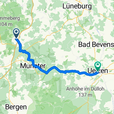
Bispingen-Schwindequelle
A cycling route starting in Bispingen, Lower Saxony, Germany.
Overview
About this route
- -:--
- Duration
- 31.9 km
- Distance
- 120 m
- Ascent
- 119 m
- Descent
- ---
- Avg. speed
- ---
- Max. altitude
Route quality
Waytypes & surfaces along the route
Waytypes
Track
15 km
(47 %)
Quiet road
8.3 km
(26 %)
Surfaces
Paved
19.8 km
(62 %)
Unpaved
8.9 km
(28 %)
Asphalt
14.4 km
(45 %)
Paved (undefined)
5.4 km
(17 %)
Continue with Bikemap
Use, edit, or download this cycling route
You would like to ride Bispingen-Schwindequelle or customize it for your own trip? Here is what you can do with this Bikemap route:
Free features
- Save this route as favorite or in collections
- Copy & plan your own version of this route
- Sync your route with Garmin or Wahoo
Premium features
Free trial for 3 days, or one-time payment. More about Bikemap Premium.
- Navigate this route on iOS & Android
- Export a GPX / KML file of this route
- Create your custom printout (try it for free)
- Download this route for offline navigation
Discover more Premium features.
Get Bikemap PremiumFrom our community
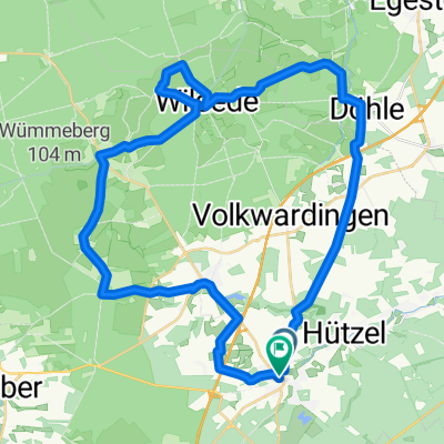
Other popular routes starting in Bispingen
 Wd08-Wildpark-Lüneburger-Heide-49km
- Distance
- 49.1 km
- Ascent
- 473 m
- Descent
- 471 m
- Location
- Bispingen, Lower Saxony, Germany
 zurück
- Distance
- 26.3 km
- Ascent
- 139 m
- Descent
- 151 m
- Location
- Bispingen, Lower Saxony, Germany
 Celle - Uelzen
- Distance
- 56.5 km
- Ascent
- 249 m
- Descent
- 284 m
- Location
- Bispingen, Lower Saxony, Germany
 Ausflug nach Wilsede😎
- Distance
- 11.5 km
- Ascent
- 95 m
- Descent
- 52 m
- Location
- Bispingen, Lower Saxony, Germany
 Bispingen-Steinbeck-Volkwardingen-Totengrund-Bispingen
- Distance
- 27.3 km
- Ascent
- 145 m
- Descent
- 148 m
- Location
- Bispingen, Lower Saxony, Germany
 Heidetour groß
- Distance
- 40.7 km
- Ascent
- 204 m
- Descent
- 202 m
- Location
- Bispingen, Lower Saxony, Germany
 gut2 bispingen
- Distance
- 19.5 km
- Ascent
- 111 m
- Descent
- 109 m
- Location
- Bispingen, Lower Saxony, Germany
 Rundtour Lüneburger Heide
- Distance
- 38.3 km
- Ascent
- 271 m
- Descent
- 263 m
- Location
- Bispingen, Lower Saxony, Germany
Open it in the app