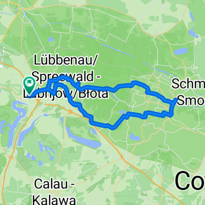
hindenberg - caputh/geltow
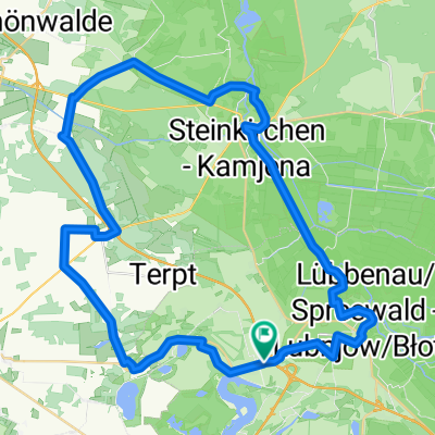
A cycling route starting in Lubnjow, Brandenburg, Germany.
Overview
About this route
it seams there was a little decommissioned airport on the way
- -:--
- Duration
- 123.6 km
- Distance
- 393 m
- Ascent
- 422 m
- Descent
- ---
- Avg. speed
- ---
- Max. altitude
Route quality
Waytypes & surfaces along the route
Waytypes
Path
37.1 km
(30 %)
Quiet road
30.9 km
(25 %)
Surfaces
Paved
103.8 km
(84 %)
Unpaved
7.4 km
(6 %)
Asphalt
101.4 km
(82 %)
Gravel
4.9 km
(4 %)
Continue with Bikemap
Use, edit, or download this cycling route
You would like to ride hindenberg - caputh/geltow or customize it for your own trip? Here is what you can do with this Bikemap route:
Free features
- Save this route as favorite or in collections
- Copy & plan your own version of this route
- Split it into stages to create a multi-day tour
- Sync your route with Garmin or Wahoo
Premium features
Free trial for 3 days, or one-time payment. More about Bikemap Premium.
- Navigate this route on iOS & Android
- Export a GPX / KML file of this route
- Create your custom printout (try it for free)
- Download this route for offline navigation
Discover more Premium features.
Get Bikemap PremiumFrom our community
Other popular routes starting in Lubnjow
- 2025-05-20_LehdeRaddusch_25km
- Distance
- 24.8 km
- Ascent
- 38 m
- Descent
- 39 m
- Location
- Lubnjow, Brandenburg, Germany
- Hy. Lübbenau-Leiper-Weg-Burg-Lübbenau
- Distance
- 26.3 km
- Ascent
- 30 m
- Descent
- 28 m
- Location
- Lubnjow, Brandenburg, Germany
- Lubbenau-Burg-Raddusch-Lubbenau
- Distance
- 39.3 km
- Ascent
- 27 m
- Descent
- 21 m
- Location
- Lubnjow, Brandenburg, Germany
- lubbenau
- Distance
- 20.7 km
- Ascent
- 29 m
- Descent
- 27 m
- Location
- Lubnjow, Brandenburg, Germany
- Gr. Lübbenau-Bischdorfersee-Göritz-Raddusch
- Distance
- 34.1 km
- Ascent
- 100 m
- Descent
- 98 m
- Location
- Lubnjow, Brandenburg, Germany
- Spreewlad Route
- Distance
- 43.3 km
- Ascent
- 22 m
- Descent
- 21 m
- Location
- Lubnjow, Brandenburg, Germany
- Hy.-A Bischd - Burg
- Distance
- 80 km
- Ascent
- 95 m
- Descent
- 97 m
- Location
- Lubnjow, Brandenburg, Germany
- Leipe über Peitz, Cottbus zurück nach Leipe
- Distance
- 79.9 km
- Ascent
- 51 m
- Descent
- 50 m
- Location
- Lubnjow, Brandenburg, Germany
Open it in the app