- 27.5 km
- 111 m
- 103 m
- Minneapolis, Minnesota, United States
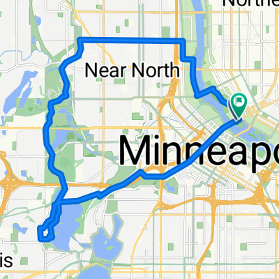
B2B00503 55408 > 55455 via Greenway, LRT, Washington
A cycling route starting in Minneapolis, Minnesota, United States.
Overview
About this route
Head south on Bryant to the Greenway entrance ramp which is just south of 28th St. Take a left onto the Greenway, and head east. When you reach 28th Street/Hiawatha, take the bike bridge over Hiawatha. (Note: before you enter onto the bridge, you must cross 28th where cross traffic does not have a stop sign.) Once over the bridge, take a left to head north along the trail (alongside the Hiawathat Light Rail). When you reach the Cedar Riverside Station, take a right onto 15th, and a right onto 6th St. Take 6th St to 20th Ave, where you take a left and head into campus. 20th will end at 4th St, where you take a right, and a quick left onto the campus bike lane. Follow that north to the bike/pedestrian bridge (Washington) and follow over the River. Once on the East bank, veer right, around the curve which backtracks toward the river. Take the river road southeast for a few blocks to Harvard, and take a left to your destination.
- -:--
- Duration
- 9.4 km
- Distance
- 86 m
- Ascent
- 106 m
- Descent
- ---
- Avg. speed
- ---
- Max. altitude
created this 17 years ago
Continue with Bikemap
Use, edit, or download this cycling route
You would like to ride B2B00503 55408 > 55455 via Greenway, LRT, Washington or customize it for your own trip? Here is what you can do with this Bikemap route:
Free features
- Save this route as favorite or in collections
- Copy & plan your own version of this route
- Sync your route with Garmin or Wahoo
Premium features
Free trial for 3 days, or one-time payment. More about Bikemap Premium.
- Navigate this route on iOS & Android
- Export a GPX / KML file of this route
- Create your custom printout (try it for free)
- Download this route for offline navigation
Discover more Premium features.
Get Bikemap PremiumFrom our community
Other popular routes starting in Minneapolis
- Willow St, Minneapolis to Spruce Pl, Minneapolis
- Central Ave SE, Minneapolis to Spruce Pl, Minneapolis
- 20 km
- 141 m
- 141 m
- Minneapolis, Minnesota, United States
- B2B00941 55405>55410 via Cedar Lake Trl, Lakes
- 11.2 km
- 77 m
- 69 m
- Minneapolis, Minnesota, United States
- Loring Park, Minneapolis to W 32nd St, Minneapolis
- 4.1 km
- 28 m
- 16 m
- Minneapolis, Minnesota, United States
- W 32nd St, Minneapolis to Yale Pl, Minneapolis
- 14.9 km
- 74 m
- 81 m
- Minneapolis, Minnesota, United States
- Route to W Lake Harriet Pkwy, Minneapolis
- 4.9 km
- 28 m
- 18 m
- Minneapolis, Minnesota, United States
- Nicollet Island Pavilion Minneapolis downtown bike ride
- 21.2 km
- 218 m
- 215 m
- Minneapolis, Minnesota, United States
- Loring Park, Minneapolis to Yale Pl, Minneapolis
- 31.4 km
- 180 m
- 181 m
- Minneapolis, Minnesota, United States
Open it in the app


