

boncuta
A cycling route starting in Crivina, Brașov County, Romania.
Overview
About this route
boncuta
- -:--
- Duration
- 53 km
- Distance
- 832 m
- Ascent
- 1,550 m
- Descent
- ---
- Avg. speed
- ---
- Max. altitude

Route quality
Waytypes & surfaces along the route
Waytypes
Quiet road
19.1 km
(36 %)
Path
9.5 km
(18 %)
Surfaces
Paved
18 km
(34 %)
Unpaved
23.8 km
(45 %)
Asphalt
17.5 km
(33 %)
Ground
17 km
(32 %)
Continue with Bikemap
Use, edit, or download this cycling route
You would like to ride boncuta or customize it for your own trip? Here is what you can do with this Bikemap route:
Free features
- Save this route as favorite or in collections
- Copy & plan your own version of this route
- Sync your route with Garmin or Wahoo
Premium features
Free trial for 3 days, or one-time payment. More about Bikemap Premium.
- Navigate this route on iOS & Android
- Export a GPX / KML file of this route
- Create your custom printout (try it for free)
- Download this route for offline navigation
Discover more Premium features.
Get Bikemap PremiumFrom our community
Other popular routes starting in Crivina
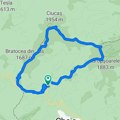 Cheia, Muntele Rosu, Ciucas, Bratocea
- Distance
- 21.7 km
- Ascent
- 1,090 m
- Descent
- 1,090 m
- Location
- Crivina, Brașov County, Romania
 Asaltul Grohotis: din Cheia la baraj Paltinul (Valea Doftana)
- Distance
- 33.6 km
- Ascent
- 680 m
- Descent
- 1,267 m
- Location
- Crivina, Brașov County, Romania
 Ciucas MTB
- Distance
- 39.4 km
- Ascent
- 801 m
- Descent
- 1,196 m
- Location
- Crivina, Brașov County, Romania
 Ocolul Ciucasului
- Distance
- 77.4 km
- Ascent
- 1,625 m
- Descent
- 1,625 m
- Location
- Crivina, Brașov County, Romania
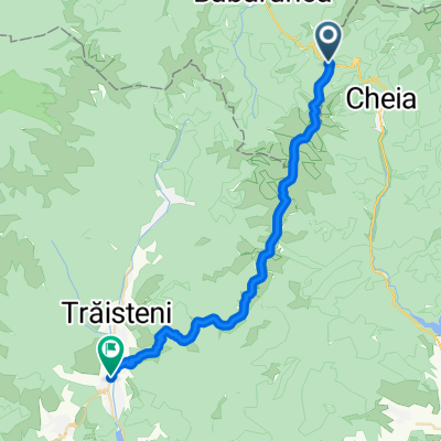
 Pasul Boncuta-Maneciu
- Distance
- 46.2 km
- Ascent
- 650 m
- Descent
- 865 m
- Location
- Crivina, Brașov County, Romania
 GrohotisMnt - BratoceaPass Peak ValeaDoftanei
- Distance
- 31.8 km
- Ascent
- 663 m
- Descent
- 1,241 m
- Location
- Crivina, Brașov County, Romania
 Varful Ciucas prin Valea Berii
- Distance
- 5.1 km
- Ascent
- 756 m
- Descent
- 67 m
- Location
- Crivina, Brașov County, Romania
 Cheia - Muntele Rosu - Cabana Ciucas - Tigaile Mari - Ocol Vf. Zaganu prin Valea Stanii - Cheia
- Distance
- 50 km
- Ascent
- 1,218 m
- Descent
- 1,218 m
- Location
- Crivina, Brașov County, Romania
Open it in the app