

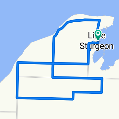
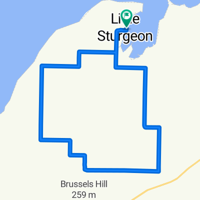
Sturgeon Bay to Fish Creek
A cycling route starting in Sturgeon Bay, Wisconsin, United States.
Overview
About this route
- 2 h 34 min
- Duration
- 45.8 km
- Distance
- 312 m
- Ascent
- 306 m
- Descent
- 17.8 km/h
- Avg. speed
- ---
- Max. altitude
Route quality
Waytypes & surfaces along the route
Waytypes
Quiet road
26.1 km
(57 %)
Road
17.9 km
(39 %)
Undefined
1.8 km
(4 %)
Surfaces
Paved
5 km
(11 %)
Asphalt
5 km
(11 %)
Undefined
40.7 km
(89 %)
Continue with Bikemap
Use, edit, or download this cycling route
You would like to ride Sturgeon Bay to Fish Creek or customize it for your own trip? Here is what you can do with this Bikemap route:
Free features
- Save this route as favorite or in collections
- Copy & plan your own version of this route
- Sync your route with Garmin or Wahoo
Premium features
Free trial for 3 days, or one-time payment. More about Bikemap Premium.
- Navigate this route on iOS & Android
- Export a GPX / KML file of this route
- Create your custom printout (try it for free)
- Download this route for offline navigation
Discover more Premium features.
Get Bikemap PremiumFrom our community
Other popular routes starting in Sturgeon Bay
 3488 Weldon Ct, Sturgeon Bay to 3488 Weldon Ct, Sturgeon Bay
- Distance
- 23.4 km
- Ascent
- 109 m
- Descent
- 108 m
- Location
- Sturgeon Bay, Wisconsin, United States
 Sturgeon Bay
- Distance
- 11.1 km
- Ascent
- 44 m
- Descent
- 70 m
- Location
- Sturgeon Bay, Wisconsin, United States
 3488 Weldon Ct, Sturgeon Bay to 3488 Weldon Ct, Sturgeon Bay
- Distance
- 29.2 km
- Ascent
- 147 m
- Descent
- 146 m
- Location
- Sturgeon Bay, Wisconsin, United States
 Door County Century Ride 2
- Distance
- 112.4 km
- Ascent
- 225 m
- Descent
- 227 m
- Location
- Sturgeon Bay, Wisconsin, United States
 6065 Lady Slipper Rd, Sturgeon Bay to 6061 Lady Slipper Rd, Sturgeon Bay
- Distance
- 47.5 km
- Ascent
- 294 m
- Descent
- 296 m
- Location
- Sturgeon Bay, Wisconsin, United States
 Park Drive 3740, Sturgeon Bay to River Road 822, Kewaunee
- Distance
- 74 km
- Ascent
- 181 m
- Descent
- 210 m
- Location
- Sturgeon Bay, Wisconsin, United States
 Recovered Route
- Distance
- 122.2 km
- Ascent
- 494 m
- Descent
- 491 m
- Location
- Sturgeon Bay, Wisconsin, United States
 Sturgeon Bay to Fish Creek
- Distance
- 45.8 km
- Ascent
- 312 m
- Descent
- 306 m
- Location
- Sturgeon Bay, Wisconsin, United States
Open it in the app