

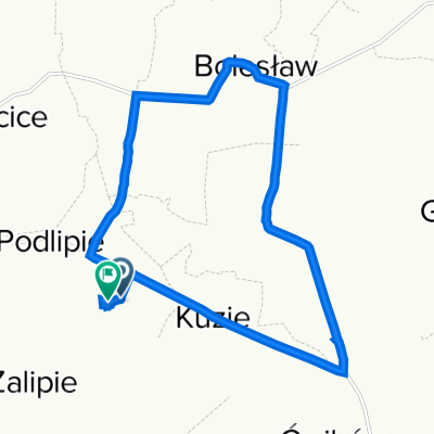
Zalipie-BursztynowySzlak-WiślanaTrasaRowerowa-Szczucin
A cycling route starting in Olesno, Lesser Poland Voivodeship, Poland.
Overview
About this route
Zalipie-Ambber Trail-Vistula Cycle Route-Szczucin
- -:--
- Duration
- 40 km
- Distance
- 0 m
- Ascent
- 4 m
- Descent
- ---
- Avg. speed
- ---
- Max. altitude
Route quality
Waytypes & surfaces along the route
Waytypes
Cycleway
23.2 km
(58 %)
Quiet road
8.8 km
(22 %)
Surfaces
Paved
37.6 km
(94 %)
Asphalt
37.6 km
(94 %)
Undefined
2.4 km
(6 %)
Route highlights
Points of interest along the route
Point of interest after 5 km
Kościół pw. św. Zygmunta w Żelichowie
Continue with Bikemap
Use, edit, or download this cycling route
You would like to ride Zalipie-BursztynowySzlak-WiślanaTrasaRowerowa-Szczucin or customize it for your own trip? Here is what you can do with this Bikemap route:
Free features
- Save this route as favorite or in collections
- Copy & plan your own version of this route
- Sync your route with Garmin or Wahoo
Premium features
Free trial for 3 days, or one-time payment. More about Bikemap Premium.
- Navigate this route on iOS & Android
- Export a GPX / KML file of this route
- Create your custom printout (try it for free)
- Download this route for offline navigation
Discover more Premium features.
Get Bikemap PremiumFrom our community
Other popular routes starting in Olesno
 Oleśnica 74C, Olesno do Prymasa Stefana Wyszyńskiego, Dąbrowa Tarnowska
- Distance
- 3.8 km
- Ascent
- 12 m
- Descent
- 3 m
- Location
- Olesno, Lesser Poland Voivodeship, Poland
 Podlipie 44, Bolesław do Podlipie 44, Bolesław
- Distance
- 27.9 km
- Ascent
- 205 m
- Descent
- 285 m
- Location
- Olesno, Lesser Poland Voivodeship, Poland
 Podlipie 50A, Bolesław do Podlipie 42, Bolesław
- Distance
- 13.1 km
- Ascent
- 113 m
- Descent
- 90 m
- Location
- Olesno, Lesser Poland Voivodeship, Poland
 Ćwików do Ćwików
- Distance
- 27.9 km
- Ascent
- 1,175 m
- Descent
- 972 m
- Location
- Olesno, Lesser Poland Voivodeship, Poland
 Pilcza Żelichowska - Sandomierz
- Distance
- 108.1 km
- Ascent
- 87 m
- Descent
- 62 m
- Location
- Olesno, Lesser Poland Voivodeship, Poland
 72a, Pilcza Żelichowska do Podlipie
- Distance
- 5.8 km
- Ascent
- 50 m
- Descent
- 41 m
- Location
- Olesno, Lesser Poland Voivodeship, Poland
 pilcza zelichowska - tarnow
- Distance
- 82.3 km
- Ascent
- 100 m
- Descent
- 101 m
- Location
- Olesno, Lesser Poland Voivodeship, Poland
 Podlipie 44, Bolesław do Podlipie 44, Bolesław
- Distance
- 9.2 km
- Ascent
- 77 m
- Descent
- 93 m
- Location
- Olesno, Lesser Poland Voivodeship, Poland
Open it in the app