

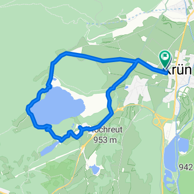
Radltour Krün über Mittenwald nach Scharnitz
A cycling route starting in Krün, Bavaria, Germany.
Overview
About this route
Radltour von Krün über Mittenwald nach Scharnitz
- -:--
- Duration
- 32.4 km
- Distance
- 396 m
- Ascent
- 397 m
- Descent
- ---
- Avg. speed
- 994 m
- Max. altitude
Route quality
Waytypes & surfaces along the route
Waytypes
Track
13.6 km
(42 %)
Quiet road
11 km
(34 %)
Surfaces
Paved
18.2 km
(56 %)
Unpaved
13.3 km
(41 %)
Asphalt
17.8 km
(55 %)
Gravel
11 km
(34 %)
Continue with Bikemap
Use, edit, or download this cycling route
You would like to ride Radltour Krün über Mittenwald nach Scharnitz or customize it for your own trip? Here is what you can do with this Bikemap route:
Free features
- Save this route as favorite or in collections
- Copy & plan your own version of this route
- Sync your route with Garmin or Wahoo
Premium features
Free trial for 3 days, or one-time payment. More about Bikemap Premium.
- Navigate this route on iOS & Android
- Export a GPX / KML file of this route
- Create your custom printout (try it for free)
- Download this route for offline navigation
Discover more Premium features.
Get Bikemap PremiumFrom our community
Other popular routes starting in Krün
 Seentour Mittenwald
- Distance
- 41.1 km
- Ascent
- 1,025 m
- Descent
- 1,018 m
- Location
- Krün, Bavaria, Germany
 Krottenkopfstraße 14, Krün nach Krottenkopfstraße 16, Krün
- Distance
- 9 km
- Ascent
- 193 m
- Descent
- 193 m
- Location
- Krün, Bavaria, Germany
 Ferchenseerunde via Garmisch
- Distance
- 37 km
- Ascent
- 640 m
- Descent
- 639 m
- Location
- Krün, Bavaria, Germany
 Gerold - Wörgl 94 km
- Distance
- 93.6 km
- Ascent
- 1,120 m
- Descent
- 1,527 m
- Location
- Krün, Bavaria, Germany
 Rundweg Krün - Fischbachalm
- Distance
- 34.6 km
- Ascent
- 1,249 m
- Descent
- 1,091 m
- Location
- Krün, Bavaria, Germany
 Kranzberg-Gipfel – Schloss Elmau Runde von Klais
- Distance
- 29.1 km
- Ascent
- 913 m
- Descent
- 910 m
- Location
- Krün, Bavaria, Germany
 An der Isar entlang Klais - Bad Tölz
- Distance
- 55.5 km
- Ascent
- 402 m
- Descent
- 650 m
- Location
- Krün, Bavaria, Germany
 Parkplatz Krün nach Weidach, Leutasch
- Distance
- 28.4 km
- Ascent
- 1,686 m
- Descent
- 1,435 m
- Location
- Krün, Bavaria, Germany
Open it in the app