

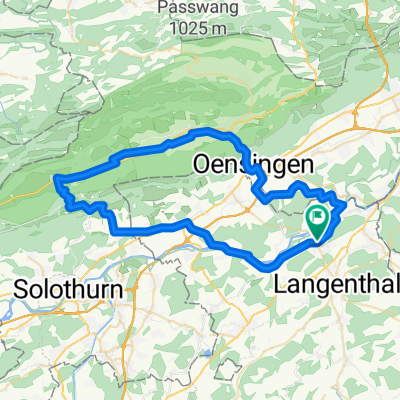
Bützberg-Günsberg-Balmberg-Weissenstein-Oberdorf-Feldbrunnen-Walliswil Bipp
A cycling route starting in Aarwangen, Canton of Bern, Switzerland.
Overview
About this route
Ridden with a good city bike, but only conditionally recommended, Balmberg-Weissenstein = rough and steep climb.
- -:--
- Duration
- 46.3 km
- Distance
- 921 m
- Ascent
- 976 m
- Descent
- ---
- Avg. speed
- ---
- Max. altitude

Route quality
Waytypes & surfaces along the route
Waytypes
Road
18.1 km
(39 %)
Quiet road
13 km
(28 %)
Surfaces
Paved
25.9 km
(56 %)
Unpaved
13 km
(28 %)
Asphalt
25.5 km
(55 %)
Gravel
7.4 km
(16 %)
Continue with Bikemap
Use, edit, or download this cycling route
You would like to ride Bützberg-Günsberg-Balmberg-Weissenstein-Oberdorf-Feldbrunnen-Walliswil Bipp or customize it for your own trip? Here is what you can do with this Bikemap route:
Free features
- Save this route as favorite or in collections
- Copy & plan your own version of this route
- Sync your route with Garmin or Wahoo
Premium features
Free trial for 3 days, or one-time payment. More about Bikemap Premium.
- Navigate this route on iOS & Android
- Export a GPX / KML file of this route
- Create your custom printout (try it for free)
- Download this route for offline navigation
Discover more Premium features.
Get Bikemap PremiumFrom our community
Other popular routes starting in Aarwangen
 Steinfeldstrasse 20, Schwarzhäusern nach Steinfeldstrasse 29, Schwarzhäusern
- Distance
- 18 km
- Ascent
- 190 m
- Descent
- 191 m
- Location
- Aarwangen, Canton of Bern, Switzerland
 Linden-Hohwacht-Langenthal-Tour
- Distance
- 31.8 km
- Ascent
- 542 m
- Descent
- 543 m
- Location
- Aarwangen, Canton of Bern, Switzerland
 Mittelland 4.Etappe Aarwangen BE-Solothurn- Brügg Be
- Distance
- 51.3 km
- Ascent
- 169 m
- Descent
- 144 m
- Location
- Aarwangen, Canton of Bern, Switzerland
 Bützberg - Faulensee (über die Mittelland-Hügelroute 84)
- Distance
- 89.3 km
- Ascent
- 558 m
- Descent
- 487 m
- Location
- Aarwangen, Canton of Bern, Switzerland
 tour3
tour3- Distance
- 94.7 km
- Ascent
- 1,030 m
- Descent
- 1,030 m
- Location
- Aarwangen, Canton of Bern, Switzerland
 Balmberg Runtour (60.3km)
- Distance
- 60.3 km
- Ascent
- 736 m
- Descent
- 732 m
- Location
- Aarwangen, Canton of Bern, Switzerland
 Workspot to wildcamp Luterbach
- Distance
- 13 km
- Ascent
- 67 m
- Descent
- 68 m
- Location
- Aarwangen, Canton of Bern, Switzerland
 Bützberg-Günsberg-Balmberg-Weissenstein-Oberdorf-Feldbrunnen-Walliswil Bipp
- Distance
- 46.3 km
- Ascent
- 921 m
- Descent
- 976 m
- Location
- Aarwangen, Canton of Bern, Switzerland
Open it in the app