

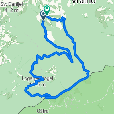
MTB po Gorjancih
A cycling route starting in Šentjernej, Občina Šentjernej, Slovenia.
Overview
About this route
- -:--
- Duration
- 19.1 km
- Distance
- 707 m
- Ascent
- 702 m
- Descent
- ---
- Avg. speed
- ---
- Max. altitude

Continue with Bikemap
Use, edit, or download this cycling route
You would like to ride MTB po Gorjancih or customize it for your own trip? Here is what you can do with this Bikemap route:
Free features
- Save this route as favorite or in collections
- Copy & plan your own version of this route
- Sync your route with Garmin or Wahoo
Premium features
Free trial for 3 days, or one-time payment. More about Bikemap Premium.
- Navigate this route on iOS & Android
- Export a GPX / KML file of this route
- Create your custom printout (try it for free)
- Download this route for offline navigation
Discover more Premium features.
Get Bikemap PremiumFrom our community
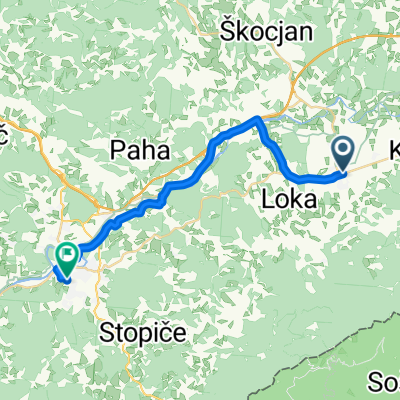
Other popular routes starting in Šentjernej
 Gospodična, Trdinov vrh
- Distance
- 21.4 km
- Ascent
- 974 m
- Descent
- 950 m
- Location
- Šentjernej, Občina Šentjernej, Slovenia
 Gorjanci
- Distance
- 25.7 km
- Ascent
- 991 m
- Descent
- 992 m
- Location
- Šentjernej, Občina Šentjernej, Slovenia
 Sv Gera - ozalj -KA-pisarovina -ZG
- Distance
- 125.1 km
- Ascent
- 420 m
- Descent
- 1,471 m
- Location
- Šentjernej, Občina Šentjernej, Slovenia
 gasper44 Šentjernej
- Distance
- 34.4 km
- Ascent
- 282 m
- Descent
- 282 m
- Location
- Šentjernej, Občina Šentjernej, Slovenia
 Camino Dolenjska day 2
- Distance
- 39.2 km
- Ascent
- 455 m
- Descent
- 532 m
- Location
- Šentjernej, Občina Šentjernej, Slovenia
 Peš v šolo 2018: ŠENTJERNEJ - NOVO MESTO
- Distance
- 22 km
- Ascent
- 140 m
- Descent
- 134 m
- Location
- Šentjernej, Občina Šentjernej, Slovenia
 Trdinov vrh _Mihovo
- Distance
- 33 km
- Ascent
- 1,043 m
- Descent
- 1,042 m
- Location
- Šentjernej, Občina Šentjernej, Slovenia
 Jakobova pot D
- Distance
- 30.1 km
- Ascent
- 459 m
- Descent
- 454 m
- Location
- Šentjernej, Občina Šentjernej, Slovenia
Open it in the app