![OFFICAL[80] Bükki Kerékpáros Teljesítménytúra 80KM](/_next/static/media/contour-lines-light-small.cafd5e5d.avif)
![OFFICAL[80] Bükki Kerékpáros Teljesítménytúra 80KM](https://media.bikemap.net/routes/5232348/staticmaps/in_c4928604-e229-4de7-b8b3-453c794c17ea_694x400_bikemap-2021-3D-static.png)
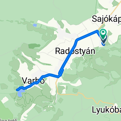
OFFICAL[80] Bükki Kerékpáros Teljesítménytúra 80KM
A cycling route starting in Sajóbábony, Borsod-Abauj Zemplen county, Hungary.
Overview
About this route
Királyasztal – Alsóhámor – Felsőhámor – Hámori-tó – Savós völgy – Létrás-tető – Jávorkút – Nagymező – Olasz kapu – Gerenna vár - Tótfalu völgy – Szilvásvárad – Nagyvisnyó – Dédestapolcsány – Mályinka - Kerek hegy – Szentlélek - Csókás – Őskohó - Hámori tó – Felsőhámor – Alsóhámor – Királyasztal Táv: 80,1 km Szintemelkedés: 1325 m Szintidő: 7 óra Indítás: 8.00-10.00 óra között Nevezési díj: 1300/1600 Ft (előnevezés/helyszíni nevezés)
- -:--
- Duration
- 75.4 km
- Distance
- 2,949 m
- Ascent
- 2,950 m
- Descent
- ---
- Avg. speed
- ---
- Avg. speed

Route quality
Waytypes & surfaces along the route
Waytypes
Busy road
40.2 km
(53 %)
Quiet road
33.8 km
(45 %)
Surfaces
Paved
56.1 km
(74 %)
Unpaved
0.6 km
(<1 %)
Asphalt
55.6 km
(74 %)
Paving stones
0.6 km
(<1 %)
Route highlights
Points of interest along the route
Drinking water after 16.1 km
1. Checkpoint
Drinking water after 33.2 km
2. Checkpoint
Drinking water after 47.7 km
3. Checkpoint
Continue with Bikemap
Use, edit, or download this cycling route
You would like to ride OFFICAL[80] Bükki Kerékpáros Teljesítménytúra 80KM or customize it for your own trip? Here is what you can do with this Bikemap route:
Free features
- Save this route as favorite or in collections
- Copy & plan your own version of this route
- Sync your route with Garmin or Wahoo
Premium features
Free trial for 3 days, or one-time payment. More about Bikemap Premium.
- Navigate this route on iOS & Android
- Export a GPX / KML file of this route
- Create your custom printout (try it for free)
- Download this route for offline navigation
Discover more Premium features.
Get Bikemap PremiumFrom our community
Other popular routes starting in Sajóbábony
 Lillafüred-Bükkfennsík-Lillafüred
- Distance
- 36.9 km
- Ascent
- 920 m
- Descent
- 769 m
- Location
- Sajóbábony, Borsod-Abauj Zemplen county, Hungary
 2019 első
- Distance
- 28.9 km
- Ascent
- 1,450 m
- Descent
- 1,510 m
- Location
- Sajóbábony, Borsod-Abauj Zemplen county, Hungary
 Lillafüred - Eger
- Distance
- 47.3 km
- Ascent
- 488 m
- Descent
- 627 m
- Location
- Sajóbábony, Borsod-Abauj Zemplen county, Hungary
 Bükki teljesítménytúra - Autómentes nap 2015
- Distance
- 114.9 km
- Ascent
- 1,496 m
- Descent
- 1,497 m
- Location
- Sajóbábony, Borsod-Abauj Zemplen county, Hungary
 Hunyadi János utca, Sajólászlófalva - Rákóczi Ferenc utca, Sajólászlófalva
- Distance
- 14.9 km
- Ascent
- 85 m
- Descent
- 86 m
- Location
- Sajóbábony, Borsod-Abauj Zemplen county, Hungary
![OFFICAL[80] Bükki Kerékpáros Teljesítménytúra 80KM](https://media.bikemap.net/routes/5232348/staticmaps/in_c4928604-e229-4de7-b8b3-453c794c17ea_400x400_bikemap-2021-3D-static.png) OFFICAL[80] Bükki Kerékpáros Teljesítménytúra 80KM
OFFICAL[80] Bükki Kerékpáros Teljesítménytúra 80KM- Distance
- 75.4 km
- Ascent
- 2,949 m
- Descent
- 2,950 m
- Location
- Sajóbábony, Borsod-Abauj Zemplen county, Hungary
 Bükki teljesítménytúra 2019 - 30km
- Distance
- 38.9 km
- Ascent
- 613 m
- Descent
- 613 m
- Location
- Sajóbábony, Borsod-Abauj Zemplen county, Hungary
 Bükk teljesítménytúra 50km
- Distance
- 47.5 km
- Ascent
- 671 m
- Descent
- 672 m
- Location
- Sajóbábony, Borsod-Abauj Zemplen county, Hungary
Open it in the app