

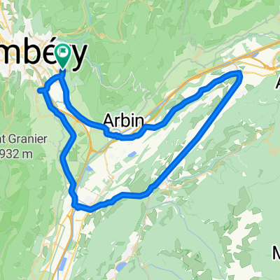
challes - col de Marocaz
A cycling route starting in Challes-les-Eaux, Auvergne-Rhône-Alpes, France.
Overview
About this route
- -:--
- Duration
- 41.8 km
- Distance
- 799 m
- Ascent
- 800 m
- Descent
- ---
- Avg. speed
- ---
- Max. altitude

Route quality
Waytypes & surfaces along the route
Waytypes
Road
23.3 km
(56 %)
Quiet road
6.8 km
(16 %)
Surfaces
Paved
26 km
(62 %)
Unpaved
2.3 km
(5 %)
Asphalt
26 km
(62 %)
Gravel
1.1 km
(3 %)
Continue with Bikemap
Use, edit, or download this cycling route
You would like to ride challes - col de Marocaz or customize it for your own trip? Here is what you can do with this Bikemap route:
Free features
- Save this route as favorite or in collections
- Copy & plan your own version of this route
- Sync your route with Garmin or Wahoo
Premium features
Free trial for 3 days, or one-time payment. More about Bikemap Premium.
- Navigate this route on iOS & Android
- Export a GPX / KML file of this route
- Create your custom printout (try it for free)
- Download this route for offline navigation
Discover more Premium features.
Get Bikemap PremiumFrom our community
Other popular routes starting in Challes-les-Eaux
 From Challes-les-Eaux to Porte-de-Savoie
- Distance
- 9.4 km
- Ascent
- 94 m
- Descent
- 74 m
- Location
- Challes-les-Eaux, Auvergne-Rhône-Alpes, France
 TT PLAINPALAIS
- Distance
- 61.3 km
- Ascent
- 1,418 m
- Descent
- 1,418 m
- Location
- Challes-les-Eaux, Auvergne-Rhône-Alpes, France
 TT ST MICHAELS MT
- Distance
- 16.5 km
- Ascent
- 437 m
- Descent
- 445 m
- Location
- Challes-les-Eaux, Auvergne-Rhône-Alpes, France
 TT ISIERE
- Distance
- 64.6 km
- Ascent
- 395 m
- Descent
- 395 m
- Location
- Challes-les-Eaux, Auvergne-Rhône-Alpes, France
 challes - col de Marocaz
- Distance
- 41.8 km
- Ascent
- 799 m
- Descent
- 800 m
- Location
- Challes-les-Eaux, Auvergne-Rhône-Alpes, France
 Chapelle du Mont St Michel - Massif des Bauges
- Distance
- 12.4 km
- Ascent
- 717 m
- Descent
- 717 m
- Location
- Challes-les-Eaux, Auvergne-Rhône-Alpes, France
 TT Col du Granier, Corbel, Chambery
- Distance
- 64.5 km
- Ascent
- 1,372 m
- Descent
- 1,372 m
- Location
- Challes-les-Eaux, Auvergne-Rhône-Alpes, France
 Alpes Chambéry / Il était une fois une jolie balade au Pays des Bauges (Frêne - Lindar - Prés) ... qui s'est terminée sous l'orage !
- Distance
- 89 km
- Ascent
- 1,699 m
- Descent
- 1,699 m
- Location
- Challes-les-Eaux, Auvergne-Rhône-Alpes, France
Open it in the app