

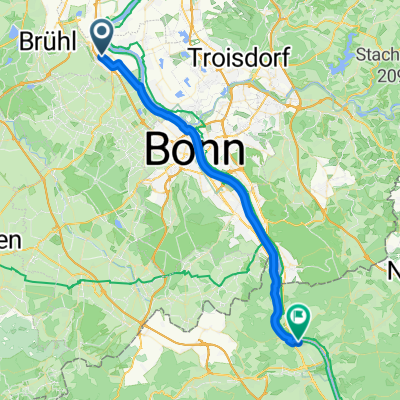
Pulheim
A cycling route starting in Wesseling, North Rhine-Westphalia, Germany.
Overview
About this route
- -:--
- Duration
- 78.5 km
- Distance
- 0 m
- Ascent
- 0 m
- Descent
- ---
- Avg. speed
- ---
- Max. altitude
Route quality
Waytypes & surfaces along the route
Waytypes
Path
44.7 km
(57 %)
Road
18.1 km
(23 %)
Surfaces
Paved
58.9 km
(75 %)
Unpaved
0.8 km
(1 %)
Asphalt
56.5 km
(72 %)
Paved (undefined)
1.6 km
(2 %)
Continue with Bikemap
Use, edit, or download this cycling route
You would like to ride Pulheim or customize it for your own trip? Here is what you can do with this Bikemap route:
Free features
- Save this route as favorite or in collections
- Copy & plan your own version of this route
- Sync your route with Garmin or Wahoo
Premium features
Free trial for 3 days, or one-time payment. More about Bikemap Premium.
- Navigate this route on iOS & Android
- Export a GPX / KML file of this route
- Create your custom printout (try it for free)
- Download this route for offline navigation
Discover more Premium features.
Get Bikemap PremiumFrom our community
Other popular routes starting in Wesseling
 Rheintour
- Distance
- 54.5 km
- Ascent
- 74 m
- Descent
- 73 m
- Location
- Wesseling, North Rhine-Westphalia, Germany
 TC Ebikertour: Lülsdorf - Lieblarer See
- Distance
- 48.1 km
- Ascent
- 122 m
- Descent
- 120 m
- Location
- Wesseling, North Rhine-Westphalia, Germany
 Berzdorf Weilerswist mittel
- Distance
- 40.3 km
- Ascent
- 191 m
- Descent
- 166 m
- Location
- Wesseling, North Rhine-Westphalia, Germany
 Flach-Fengler-Straße, Wesseling nach Goethestraße, Remagen
- Distance
- 37.5 km
- Ascent
- 192 m
- Descent
- 186 m
- Location
- Wesseling, North Rhine-Westphalia, Germany
 Sonntags Rundfahrt
- Distance
- 25.8 km
- Ascent
- 22 m
- Descent
- 23 m
- Location
- Wesseling, North Rhine-Westphalia, Germany
 Radtour zum Lieblarer See
- Distance
- 34.5 km
- Ascent
- 140 m
- Descent
- 139 m
- Location
- Wesseling, North Rhine-Westphalia, Germany
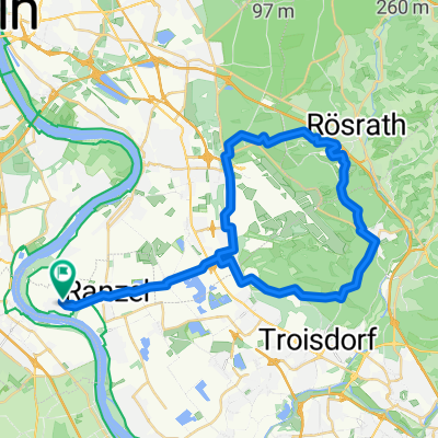 RadtourWahnerHeide2019
- Distance
- 41.4 km
- Ascent
- 147 m
- Descent
- 149 m
- Location
- Wesseling, North Rhine-Westphalia, Germany
 Am Rhein entlang und zurück
- Distance
- 20.3 km
- Ascent
- 53 m
- Descent
- 49 m
- Location
- Wesseling, North Rhine-Westphalia, Germany
Open it in the app