

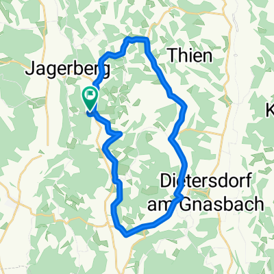
Große, schöne Panoramarunde
A cycling route starting in Jagerberg, Styria, Austria.
Overview
About this route
This route runs almost entirely on paved secondary roads along the ridges between Jagerberg, St. Peter/Ottersbach, and Mettersdorf. Numerous vineyards, many corn and apple orchards can be seen along this route, as well as wonderful panoramas and views of the most beautiful and luxurious private houses in the area.
- -:--
- Duration
- 28.1 km
- Distance
- 414 m
- Ascent
- 404 m
- Descent
- ---
- Avg. speed
- ---
- Max. altitude

Route quality
Waytypes & surfaces along the route
Waytypes
Quiet road
20.5 km
(73 %)
Road
2.5 km
(9 %)
Surfaces
Paved
27 km
(96 %)
Asphalt
27 km
(96 %)
Undefined
1.1 km
(4 %)
Continue with Bikemap
Use, edit, or download this cycling route
You would like to ride Große, schöne Panoramarunde or customize it for your own trip? Here is what you can do with this Bikemap route:
Free features
- Save this route as favorite or in collections
- Copy & plan your own version of this route
- Sync your route with Garmin or Wahoo
Premium features
Free trial for 3 days, or one-time payment. More about Bikemap Premium.
- Navigate this route on iOS & Android
- Export a GPX / KML file of this route
- Create your custom printout (try it for free)
- Download this route for offline navigation
Discover more Premium features.
Get Bikemap PremiumFrom our community
Other popular routes starting in Jagerberg
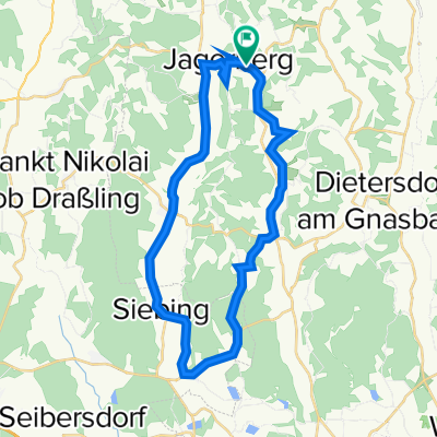
 kurze Hügelrunde
- Distance
- 15.6 km
- Ascent
- 279 m
- Descent
- 279 m
- Location
- Jagerberg, Styria, Austria
 Mittellange Route zur Panoramakapelle Glojach ab Jagerberg
- Distance
- 23.5 km
- Ascent
- 390 m
- Descent
- 390 m
- Location
- Jagerberg, Styria, Austria
 Große Hauptstraßen-Runde Jagerberg - Mettersdorf - Weinburg - St. Peter - Jagerberg
- Distance
- 38.8 km
- Ascent
- 331 m
- Descent
- 333 m
- Location
- Jagerberg, Styria, Austria
 Unterzirknitz-Unterauersbach-Bierbaum-St.Peter-Unterzirknitz
- Distance
- 22.1 km
- Ascent
- 168 m
- Descent
- 168 m
- Location
- Jagerberg, Styria, Austria
 Jagerberg 141, Jagerberg nach Jagerberg 141, Jagerberg
- Distance
- 30.7 km
- Ascent
- 279 m
- Descent
- 279 m
- Location
- Jagerberg, Styria, Austria
 Abendrunde_Jagerberg - Weinburg - St. Peter - Jagerberg
- Distance
- 35.6 km
- Ascent
- 355 m
- Descent
- 355 m
- Location
- Jagerberg, Styria, Austria
 Große Runde Jagerberg - Straden - Buschenschank - Jagerberg
- Distance
- 38 km
- Ascent
- 684 m
- Descent
- 678 m
- Location
- Jagerberg, Styria, Austria
 Jagerberg-Kirchbach-Kirchberg-Feldbach-Hof-Jagerberg
- Distance
- 82.4 km
- Ascent
- 622 m
- Descent
- 622 m
- Location
- Jagerberg, Styria, Austria
Open it in the app