Creemore Spring Classic
- 45.3 km
- 630 m
- 590 m
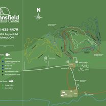
- Angus, Ontario, Canada
A cycling route starting in Angus, Ontario, Canada.
Overview
created this 6 years ago
Route quality
Quiet road
1.2 km
28 %
Undefined
3 km
72 %
Paved
1 km
(25 %)
Asphalt
0.6 km
15 %
Paved (undefined)
0.4 km
10 %
Undefined
3.1 km
75 %
Continue with Bikemap
You would like to ride 中等路线 阿加拉-托索朗提奥 or customize it for your own trip? Here is what you can do with this Bikemap route:
Free trial for 3 days, or one-time payment. More about Bikemap Premium.
Discover more Premium features.
Get Bikemap PremiumFrom our community
Open it in the app