

GTMC
Murol / Saint-Alyre-ès-Montagne
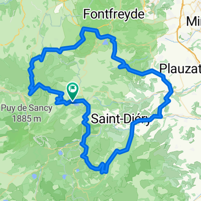
A cycling route starting in Le Mont-Dore, Auvergne-Rhône-Alpes, France.
Overview
About this route
The views in this part are stunning and the atmospheres... changing! From the very beautiful medieval village of Besse, you reach the impressive Lac Pavin and then the Lac de Montcineyre. We are in the Cezallier: the steep slopes give way to the gentle and rounded curves of the vast summer pastures, domain of herds of cows. The La Godivelle nature reserve offers landscapes of peat bogs, and the lakes d'En-Haut and d'En-Bas are not to be missed before arriving at the hamlet of Jassy. We arrive at the hamlet of Jassy.
The GTMC trail passes behind Lac Chambon and avoids the town of Murol where one can nevertheless resupply. We travel along small roads and a good volcanic path that gradually climbs to the place called les Jassat. After Besse, the route is very rolling, on good track and small road. The itinerary alternates between large tracks and small roads and allows you to take your time to escape into the landscape.
- -:--
- Duration
- 39.2 km
- Distance
- 1,088 m
- Ascent
- 809 m
- Descent
- ---
- Avg. speed
- ---
- Max. altitude

Part of
6 stages
Route quality
Waytypes & surfaces along the route
Waytypes
Track
19.6 km
(50 %)
Quiet road
10.2 km
(26 %)
Surfaces
Paved
9.4 km
(24 %)
Unpaved
11.8 km
(30 %)
Asphalt
7.1 km
(18 %)
Gravel
6.7 km
(17 %)
Continue with Bikemap
Use, edit, or download this cycling route
You would like to ride Murol / Saint-Alyre-ès-Montagne or customize it for your own trip? Here is what you can do with this Bikemap route:
Free features
- Save this route as favorite or in collections
- Copy & plan your own version of this route
- Sync your route with Garmin or Wahoo
Premium features
Free trial for 3 days, or one-time payment. More about Bikemap Premium.
- Navigate this route on iOS & Android
- Export a GPX / KML file of this route
- Create your custom printout (try it for free)
- Download this route for offline navigation
Discover more Premium features.
Get Bikemap PremiumFrom our community
Other popular routes starting in Le Mont-Dore
 Mont-Dore Trip#2 80km
- Distance
- 80.9 km
- Ascent
- 1,649 m
- Descent
- 1,604 m
- Location
- Le Mont-Dore, Auvergne-Rhône-Alpes, France
 Puy de dome 2 - Mont Doré - Sancy
- Distance
- 85 km
- Ascent
- 1,406 m
- Descent
- 1,413 m
- Location
- Le Mont-Dore, Auvergne-Rhône-Alpes, France
 Boucle nord Mont Dore
- Distance
- 64.1 km
- Ascent
- 949 m
- Descent
- 948 m
- Location
- Le Mont-Dore, Auvergne-Rhône-Alpes, France
 Boucle Est Mont Dore
- Distance
- 93.6 km
- Ascent
- 1,610 m
- Descent
- 1,612 m
- Location
- Le Mont-Dore, Auvergne-Rhône-Alpes, France
 France 4 - Massif Central 2
- Distance
- 107.7 km
- Ascent
- 1,542 m
- Descent
- 1,542 m
- Location
- Le Mont-Dore, Auvergne-Rhône-Alpes, France
 3.etapa Mont-Dore - Riom-es-Montagnes
- Distance
- 71.2 km
- Ascent
- 1,218 m
- Descent
- 1,380 m
- Location
- Le Mont-Dore, Auvergne-Rhône-Alpes, France
 2019-25 Le-Mont-Dore to Riom-ès-Montagnes
- Distance
- 60.4 km
- Ascent
- 716 m
- Descent
- 893 m
- Location
- Le Mont-Dore, Auvergne-Rhône-Alpes, France
 Mont dore tour du lac Chambon
- Distance
- 38.6 km
- Ascent
- 938 m
- Descent
- 938 m
- Location
- Le Mont-Dore, Auvergne-Rhône-Alpes, France
Open it in the app