

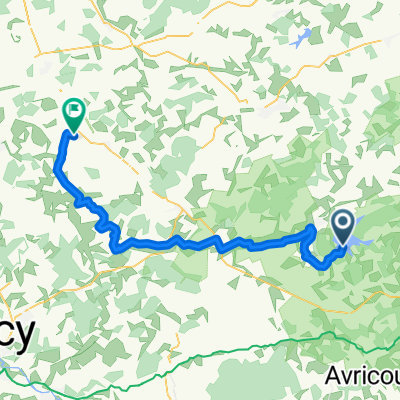
autour de l'etang de LINDRE
A cycling route starting in Dieuze, Grand Est, France.
Overview
About this route
Peaceful circuit around the LINDRE pond with an approach to the STOCK pond
- -:--
- Duration
- 54.5 km
- Distance
- 296 m
- Ascent
- 295 m
- Descent
- ---
- Avg. speed
- ---
- Max. altitude
Route quality
Waytypes & surfaces along the route
Waytypes
Road
32.1 km
(59 %)
Quiet road
12 km
(22 %)
Surfaces
Paved
47.9 km
(88 %)
Asphalt
47.9 km
(88 %)
Undefined
6.5 km
(12 %)
Continue with Bikemap
Use, edit, or download this cycling route
You would like to ride autour de l'etang de LINDRE or customize it for your own trip? Here is what you can do with this Bikemap route:
Free features
- Save this route as favorite or in collections
- Copy & plan your own version of this route
- Sync your route with Garmin or Wahoo
Premium features
Free trial for 3 days, or one-time payment. More about Bikemap Premium.
- Navigate this route on iOS & Android
- Export a GPX / KML file of this route
- Create your custom printout (try it for free)
- Download this route for offline navigation
Discover more Premium features.
Get Bikemap PremiumFrom our community
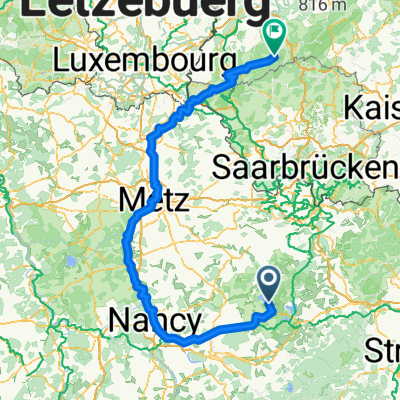
Other popular routes starting in Dieuze
 4 Tarquimpol - Alaincourt-la-Côte
- Distance
- 57.8 km
- Ascent
- 356 m
- Descent
- 314 m
- Location
- Dieuze, Grand Est, France
 Itinéraire modéré en Guinzeling
- Distance
- 12.6 km
- Ascent
- 667 m
- Descent
- 661 m
- Location
- Dieuze, Grand Est, France
 Et3 : Tarquimpol - Wettolsheim - 2015
- Distance
- 149.6 km
- Ascent
- 988 m
- Descent
- 991 m
- Location
- Dieuze, Grand Est, France
 sarrebourg
- Distance
- 26.1 km
- Ascent
- 244 m
- Descent
- 209 m
- Location
- Dieuze, Grand Est, France
 autour de l'etang de LINDRE
- Distance
- 54.5 km
- Ascent
- 296 m
- Descent
- 295 m
- Location
- Dieuze, Grand Est, France
 Les p’tits bled’s
- Distance
- 14.8 km
- Ascent
- 130 m
- Descent
- 136 m
- Location
- Dieuze, Grand Est, France
 Itinéraire modéré en Val-de-Bride
- Distance
- 3.5 km
- Ascent
- 26 m
- Descent
- 40 m
- Location
- Dieuze, Grand Est, France
 Pfungstadt - Rohrbach-lès-Bitche + Rohrbach-lès-Bitche - Metz (2/2) + Metz - Trier (1/2)
- Distance
- 248.7 km
- Ascent
- 1,813 m
- Descent
- 1,542 m
- Location
- Dieuze, Grand Est, France
Open it in the app