Rundfahrt von Gänserndorf bis nach Raggendorf
A cycling route starting in Gänserndorf, Lower Austria, Austria.
Overview
About this route
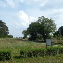
This route leads from the Gänserndorf train station along Dörfleserstraße to Dörfles, where you follow the cycle path to Tallesbrunn. There, you continue on the cycle path to Prottes, riding through the town to follow cycle route No. 5 to Raggendorf. On this section, there is a part that is not very well paved, please ride carefully here! Before Raggendorf, there is a hill to conquer, and after Raggendorf, it goes up and down slightly until Schönkirchen, which is only briefly touched upon. The final stretch goes over nicely paved farm roads back to Gänserndorf, following the cycle path from there to the train station.
- 2 h 1 min
- Duration
- 29.7 km
- Distance
- 97 m
- Ascent
- 96 m
- Descent
- 14.8 km/h
- Avg. speed
- ---
- Max. altitude
Route photos
Route quality
Waytypes & surfaces along the route
Waytypes
Quiet road
22.9 km
(77 %)
Track
2.4 km
(8 %)
Surfaces
Paved
22.6 km
(76 %)
Unpaved
4.2 km
(14 %)
Asphalt
20.5 km
(69 %)
Gravel
4.2 km
(14 %)
Continue with Bikemap
Use, edit, or download this cycling route
You would like to ride Rundfahrt von Gänserndorf bis nach Raggendorf or customize it for your own trip? Here is what you can do with this Bikemap route:
Free features
- Save this route as favorite or in collections
- Copy & plan your own version of this route
- Sync your route with Garmin or Wahoo
Premium features
Free trial for 3 days, or one-time payment. More about Bikemap Premium.
- Navigate this route on iOS & Android
- Export a GPX / KML file of this route
- Create your custom printout (try it for free)
- Download this route for offline navigation
Discover more Premium features.
Get Bikemap PremiumFrom our community
Other popular routes starting in Gänserndorf
 Gänserndorf Runde tom
- Distance
- 21.6 km
- Ascent
- 41 m
- Descent
- 41 m
- Location
- Gänserndorf, Lower Austria, Austria
 Gänserndorf - Strasshof - Deutsch Wagram - Marchfeldkanal - Markgrafneusiedl - Gänserndorf
- Distance
- 39.6 km
- Ascent
- 67 m
- Descent
- 67 m
- Location
- Gänserndorf, Lower Austria, Austria
 Gänserndorf - Mannersdorf (Rochusberg)
- Distance
- 14.9 km
- Ascent
- 31 m
- Descent
- 26 m
- Location
- Gänserndorf, Lower Austria, Austria
 Gänserndorf - Prottes - Groß Schweinbarth - Auersthal - Gänserndorf
- Distance
- 33.4 km
- Ascent
- 140 m
- Descent
- 142 m
- Location
- Gänserndorf, Lower Austria, Austria
 Der Traminer - Alternative von Gänserndorf startend
- Distance
- 63.1 km
- Ascent
- 411 m
- Descent
- 413 m
- Location
- Gänserndorf, Lower Austria, Austria
 Radtour "Dampfross und Drahtesel" von Gänserndorf startend
- Distance
- 68.8 km
- Ascent
- 60 m
- Descent
- 60 m
- Location
- Gänserndorf, Lower Austria, Austria
 Ausfahrt durch Gänserndorf
- Distance
- 11.9 km
- Ascent
- 29 m
- Descent
- 27 m
- Location
- Gänserndorf, Lower Austria, Austria
 Von Gänserndorf über Deutsch Wagram zur Lourdes-Kapelle bei Groß Engersdorf und über Bockfließ zurück nach Gänserndorf
- Distance
- 38.8 km
- Ascent
- 39 m
- Descent
- 39 m
- Location
- Gänserndorf, Lower Austria, Austria
Open it in the app


