

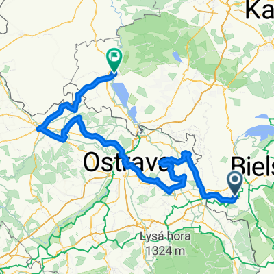
Lysa hora
A cycling route starting in Goleszów, Silesian Voivodeship, Poland.
Overview
About this route
- -:--
- Duration
- 196.4 km
- Distance
- 1,839 m
- Ascent
- 1,821 m
- Descent
- ---
- Avg. speed
- ---
- Max. altitude

Route quality
Waytypes & surfaces along the route
Waytypes
Quiet road
68.7 km
(35 %)
Road
53 km
(27 %)
Surfaces
Paved
111.9 km
(57 %)
Unpaved
3.9 km
(2 %)
Asphalt
110 km
(56 %)
Paved (undefined)
2 km
(1 %)
Continue with Bikemap
Use, edit, or download this cycling route
You would like to ride Lysa hora or customize it for your own trip? Here is what you can do with this Bikemap route:
Free features
- Save this route as favorite or in collections
- Copy & plan your own version of this route
- Split it into stages to create a multi-day tour
- Sync your route with Garmin or Wahoo
Premium features
Free trial for 3 days, or one-time payment. More about Bikemap Premium.
- Navigate this route on iOS & Android
- Export a GPX / KML file of this route
- Create your custom printout (try it for free)
- Download this route for offline navigation
Discover more Premium features.
Get Bikemap PremiumFrom our community
Other popular routes starting in Goleszów
 Pasmo Czantoria i Stożek
- Distance
- 127.6 km
- Ascent
- 911 m
- Descent
- 983 m
- Location
- Goleszów, Silesian Voivodeship, Poland
 Goleszów - Czantoria - Wisła - Goleszów
- Distance
- 39.2 km
- Ascent
- 799 m
- Descent
- 799 m
- Location
- Goleszów, Silesian Voivodeship, Poland
 Dookoła pasma Czantoria - Stożek
- Distance
- 55.5 km
- Ascent
- 1,271 m
- Descent
- 1,190 m
- Location
- Goleszów, Silesian Voivodeship, Poland
 Goleszów 1
- Distance
- 69.7 km
- Ascent
- 643 m
- Descent
- 643 m
- Location
- Goleszów, Silesian Voivodeship, Poland
 Goleszów - BIELY KRIŻ / TERCHOVA - Rajcza (2dni)
- Distance
- 196.2 km
- Ascent
- 1,753 m
- Descent
- 1,628 m
- Location
- Goleszów, Silesian Voivodeship, Poland
 Czechy
- Distance
- 157 km
- Ascent
- 389 m
- Descent
- 538 m
- Location
- Goleszów, Silesian Voivodeship, Poland
 Goleszów - RADHOST / LYSA HORA - Cieszyn (Goleszów) 2dni
- Distance
- 176.9 km
- Ascent
- 2,297 m
- Descent
- 2,355 m
- Location
- Goleszów, Silesian Voivodeship, Poland
 Goleszów-Mała Czantoria-Goleszów
- Distance
- 22.5 km
- Ascent
- 865 m
- Descent
- 801 m
- Location
- Goleszów, Silesian Voivodeship, Poland
Open it in the app