Burcak_15_2
- 43.5 km
- 489 m
- 487 m
- Velké Pavlovice, South Moravian, Czechia
A cycling route starting in Velké Pavlovice, South Moravian, Czechia.
Overview
Author: Petr Škotko
The beauties of South Moravia attract more and more cycle tourists year by year. On one hand, simply because cycle tourism is becoming an increasingly attractive form of leisure and quality equipment is financially accessible. On the other hand, South Moravia offers beautiful cycle paths and routes, a vast number of monuments and culture, and excellent wine. It is no surprise that from June to September you will encounter hundreds of wine cellars and wineries with excellent wine and hospitality. A bit contradictory regarding whether a cyclist can drink alcohol or not, but the temptation is very strong. And police officers are only human too...
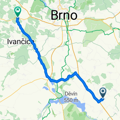
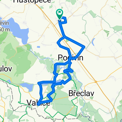
For today's, already the fourth installment of cycle routes, I will use my May visit to South Moravia and choose the picturesque town of Velké Pavlovice (48.9046919N, 16.8160497E) as the start of the circuit, which is between 35 and 37 kilometers. It is home to over 3000 inhabitants and is known mainly for two things – the Cellar Alley under the Old Hill (so-called Drunken Cellars) and the nearby Slunečná lookout tower on the Modré hory cycle path. From Pavlovice we will take the André, Moravská vinná cycle route to the village of Starovičky (48.9074667N, 16.7753708E). During the liberation of Czechoslovakia in 1945, on April 16, a battle took place near the village of a Russian tank against a fourfold superior force. The Russian T-34 destroyed three enemy tanks and one cannon. Reinforcements from both sides then joined the battle. After about 30 minutes of fighting, the Germans retreated to Hustopeče. There is also a memorial there commemorating this battle.
Continuing on a local road we arrive at Šakvice (48.8974589N, 16.7142389E). This village also has a turbulent history. On the night of December 24, 1953, at the Šakvice railway station on the Brno–Břeclav line, the second largest railway accident in the Czech lands occurred: in a collision between an express train and a passenger train 103 people died and 83 were injured. The event is commemorated by a plaque on the railway building.
From Šakvice we head to the dam of the monumental Nové Mlýny waterworks and along its dam past the village of Strachotín to Dolní Věstonice (48.8872214N, 16.6438511E). It is probably not necessary to introduce the village where the famous Venus of Věstonice was found in 1925.
Just under four kilometers leads us past Nové Mlýny again to the small wine village of Pavlov (48.8741567N, 16.6722544E), whose dominant feature is the Archeopark Pavlov, a unique museum on the site of mammoth hunters' settlement. It is worth visiting and the entrance fee of 90 crowns is reasonable, but since you have to leave bikes outside, it is good to go in two groups.
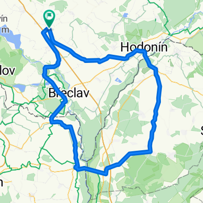
From Pavlov we then take cycle route 5043 Mikulovská to Milovice, from there along a local road to Nové Mlýny, and at the junction before the village, we turn left and around the waterworks to the dam, where we turn sharply right onto cycle route 5066 Velkopavlovická to the village of Zaječí (48.8729503N, 16.7664611E). It is also famous, but sadly. In 1831 it was hit by a great fire that burned down 134 houses, 72 barns, and wine presses. Cholera epidemics raged here three times. From 1836 to 1860, 60 people died, in 1855 70 people died, and in 1866 140 died.
From Zaječí it is eight kilometers to Velké Pavlovice. The route we have taken is not difficult in terms of terrain, but definitely in terms of fitness. It completely contradicts the claim that South Moravia is one big plain. Have a safe journey and one piece of advice at the end – you definitely do not have to worry about suffering from hunger or thirst!
created this 6 years ago
Route quality
Road
13.6 km
(45 %)
Track
6.3 km
(21 %)
Paved
21.7 km
(72 %)
Unpaved
4.8 km
(16 %)
Asphalt
20.5 km
(68 %)
Unpaved (undefined)
2.1 km
(7 %)
Continue with Bikemap
You would like to ride Jižní Morava aneb Cesta za kouzlem vinic, krásné přírody a dávnými příběhy or customize it for your own trip? Here is what you can do with this Bikemap route:
Free trial for 3 days, or one-time payment. More about Bikemap Premium.
Discover more Premium features.
Get Bikemap PremiumFrom our community
Open it in the app