

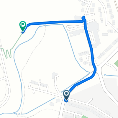
Persley
A cycling route starting in Dyce, Scotland, United Kingdom.
Overview
About this route
Home to persley and back via grandholm bridge
- -:--
- Duration
- 15.3 km
- Distance
- 150 m
- Ascent
- 187 m
- Descent
- ---
- Avg. speed
- ---
- Max. altitude
Route quality
Waytypes & surfaces along the route
Waytypes
Quiet road
8.9 km
(58 %)
Path
2.3 km
(15 %)
Surfaces
Paved
11.3 km
(74 %)
Unpaved
0.3 km
(2 %)
Asphalt
11.3 km
(74 %)
Unpaved (undefined)
0.3 km
(2 %)
Undefined
3.7 km
(24 %)
Continue with Bikemap
Use, edit, or download this cycling route
You would like to ride Persley or customize it for your own trip? Here is what you can do with this Bikemap route:
Free features
- Save this route as favorite or in collections
- Copy & plan your own version of this route
- Sync your route with Garmin or Wahoo
Premium features
Free trial for 3 days, or one-time payment. More about Bikemap Premium.
- Navigate this route on iOS & Android
- Export a GPX / KML file of this route
- Create your custom printout (try it for free)
- Download this route for offline navigation
Discover more Premium features.
Get Bikemap PremiumFrom our community
Other popular routes starting in Dyce
 Formartine & Buchan Way (Dyce Station loop)
- Distance
- 165.9 km
- Ascent
- 991 m
- Descent
- 994 m
- Location
- Dyce, Scotland, United Kingdom
 Route from Argyll Road 27
- Distance
- 73.8 km
- Ascent
- 611 m
- Descent
- 657 m
- Location
- Dyce, Scotland, United Kingdom
 Coubert Road 21, Newmachar to Ebrieside 1, Auchnagatt
- Distance
- 25.6 km
- Ascent
- 228 m
- Descent
- 305 m
- Location
- Dyce, Scotland, United Kingdom
 Aberdeen-Southhampton 2016
- Distance
- 1,689.6 km
- Ascent
- 2,232 m
- Descent
- 2,271 m
- Location
- Dyce, Scotland, United Kingdom
 Argyll Road 27 to Station Road
- Distance
- 71.2 km
- Ascent
- 477 m
- Descent
- 520 m
- Location
- Dyce, Scotland, United Kingdom
 Work Journey (Back Road)
- Distance
- 9.6 km
- Ascent
- 60 m
- Descent
- 88 m
- Location
- Dyce, Scotland, United Kingdom
 Route from 79 Greenburn Road, Aberdeen
- Distance
- 0.6 km
- Ascent
- 0 m
- Descent
- 4 m
- Location
- Dyce, Scotland, United Kingdom
 Dyce Aberdeen
- Distance
- 12.2 km
- Ascent
- 97 m
- Descent
- 129 m
- Location
- Dyce, Scotland, United Kingdom
Open it in the app