

Rundkurs-Schliengen-Buggingen
A cycling route starting in Schliengen, Baden-Wurttemberg, Germany.
Overview
About this route
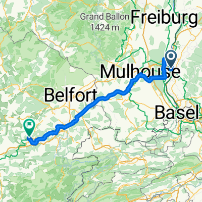
Loop route from Schliengen via Kandern, Sehringen, Badenweiler, Dattingen to Buggingen and back along the B3
- -:--
- Duration
- 41.8 km
- Distance
- 687 m
- Ascent
- 696 m
- Descent
- ---
- Avg. speed
- 568 m
- Max. altitude

Route quality
Waytypes & surfaces along the route
Waytypes
Track
8.8 km
(21 %)
Road
7.9 km
(19 %)
Surfaces
Paved
36.7 km
(88 %)
Unpaved
0.8 km
(2 %)
Asphalt
36.3 km
(87 %)
Paved (undefined)
0.4 km
(1 %)
Continue with Bikemap
Use, edit, or download this cycling route
You would like to ride Rundkurs-Schliengen-Buggingen or customize it for your own trip? Here is what you can do with this Bikemap route:
Free features
- Save this route as favorite or in collections
- Copy & plan your own version of this route
- Sync your route with Garmin or Wahoo
Premium features
Free trial for 3 days, or one-time payment. More about Bikemap Premium.
- Navigate this route on iOS & Android
- Export a GPX / KML file of this route
- Create your custom printout (try it for free)
- Download this route for offline navigation
Discover more Premium features.
Get Bikemap PremiumFrom our community
Other popular routes starting in Schliengen
 Sonntagabendtour nach Käsacker - Kandertal - Efringen - Schliengen
- Distance
- 59.2 km
- Ascent
- 496 m
- Descent
- 496 m
- Location
- Schliengen, Baden-Wurttemberg, Germany
 Steinenstadt - I´Isle-sur-le-Doubs (F) 23.08.07
- Distance
- 116.6 km
- Ascent
- 409 m
- Descent
- 315 m
- Location
- Schliengen, Baden-Wurttemberg, Germany
 Samstagstour durchs Markgräflerland und Schwarzwald
- Distance
- 77.9 km
- Ascent
- 923 m
- Descent
- 922 m
- Location
- Schliengen, Baden-Wurttemberg, Germany
 Schliengener Rundfahrt
- Distance
- 20.6 km
- Ascent
- 409 m
- Descent
- 328 m
- Location
- Schliengen, Baden-Wurttemberg, Germany
 zum Hochblauen
- Distance
- 47.5 km
- Ascent
- 1,072 m
- Descent
- 1,072 m
- Location
- Schliengen, Baden-Wurttemberg, Germany
 Mauchen-Basel-Burnhaupt
- Distance
- 105.5 km
- Ascent
- 732 m
- Descent
- 691 m
- Location
- Schliengen, Baden-Wurttemberg, Germany
 Samstagstour 08.03.2025
- Distance
- 71.9 km
- Ascent
- 1,127 m
- Descent
- 1,128 m
- Location
- Schliengen, Baden-Wurttemberg, Germany
 Blauen Tour
- Distance
- 55.8 km
- Ascent
- 1,092 m
- Descent
- 1,092 m
- Location
- Schliengen, Baden-Wurttemberg, Germany
Open it in the app