

euro 2019
A cycling route starting in Donaueschingen, Baden-Wurttemberg, Germany.
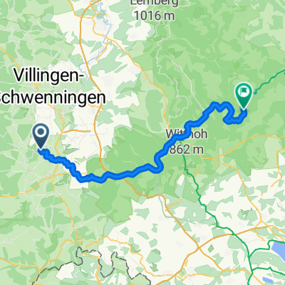
Overview
About this route
toata ruta
- -:--
- Duration
- 848.4 km
- Distance
- 219 m
- Ascent
- 741 m
- Descent
- ---
- Avg. speed
- ---
- Max. altitude

Route quality
Waytypes & surfaces along the route
Waytypes
Track
254.5 km
(30 %)
Quiet road
212.1 km
(25 %)
Surfaces
Paved
678.7 km
(80 %)
Unpaved
93.3 km
(11 %)
Asphalt
661.7 km
(78 %)
Gravel
67.9 km
(8 %)
Route highlights
Points of interest along the route
Point of interest after 89.1 km
prima zi
Point of interest after 180.3 km
ulm
Continue with Bikemap
Use, edit, or download this cycling route
You would like to ride euro 2019 or customize it for your own trip? Here is what you can do with this Bikemap route:
Free features
- Save this route as favorite or in collections
- Copy & plan your own version of this route
- Split it into stages to create a multi-day tour
- Sync your route with Garmin or Wahoo
Premium features
Free trial for 3 days, or one-time payment. More about Bikemap Premium.
- Navigate this route on iOS & Android
- Export a GPX / KML file of this route
- Create your custom printout (try it for free)
- Download this route for offline navigation
Discover more Premium features.
Get Bikemap PremiumFrom our community
Other popular routes starting in Donaueschingen
 Le Danube - 1ere partie
- Distance
- 932.4 km
- Ascent
- 318 m
- Descent
- 768 m
- Location
- Donaueschingen, Baden-Wurttemberg, Germany
 31km-DonauEntspring Donaueschingen
- Distance
- 31.3 km
- Ascent
- 180 m
- Descent
- 181 m
- Location
- Donaueschingen, Baden-Wurttemberg, Germany
 Die Donaueschingen-Siofók-Hypothese
- Distance
- 1,220.5 km
- Ascent
- 115 m
- Descent
- 680 m
- Location
- Donaueschingen, Baden-Wurttemberg, Germany
 An der Donau entlang
- Distance
- 165.5 km
- Ascent
- 403 m
- Descent
- 591 m
- Location
- Donaueschingen, Baden-Wurttemberg, Germany
 Donaueschingen - Fürstenberg - Geisingen - Donaueschingen
- Distance
- 50.2 km
- Ascent
- 249 m
- Descent
- 249 m
- Location
- Donaueschingen, Baden-Wurttemberg, Germany
 Donautal
- Distance
- 52.4 km
- Ascent
- 316 m
- Descent
- 321 m
- Location
- Donaueschingen, Baden-Wurttemberg, Germany
 From Donaueschingen to Fridingen an der Donau
- Distance
- 61.9 km
- Ascent
- 439 m
- Descent
- 504 m
- Location
- Donaueschingen, Baden-Wurttemberg, Germany
 Donautour 1.Etappe
- Distance
- 99.3 km
- Ascent
- 311 m
- Descent
- 407 m
- Location
- Donaueschingen, Baden-Wurttemberg, Germany
Open it in the app