Consolación
- 29.8 km
- 113 m
- 170 m
- Valdepeñas, Castille-La Mancha, Spain
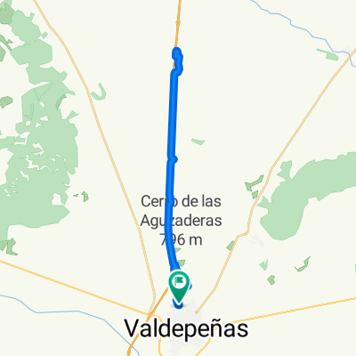
A cycling route starting in Valdepeñas, Castille-La Mancha, Spain.
Overview
Departure by the treatment plant and after passing the A-4, through the Cerro el Indio path to the airfield. Continuation towards the Moral-Santa Cruz road and search for the Cortijada Madrileña estate (CRESYRA) and then continue through the Agrupadas estate and the return parallel to the Jabalón.
created this 15 years ago
Continue with Bikemap
You would like to ride Ruta por Aerodromo, CRESYRA y agrupadas or customize it for your own trip? Here is what you can do with this Bikemap route:
Free trial for 3 days, or one-time payment. More about Bikemap Premium.
Discover more Premium features.
Get Bikemap PremiumFrom our community
Open it in the app