

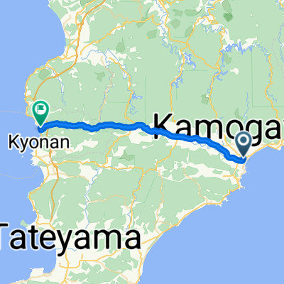
Boso S3: Awa Kamogawa - Kanaya
A cycling route starting in Kamogawa, Chiba, Japan.
Overview
About this route
- -:--
- Duration
- 92.7 km
- Distance
- 218 m
- Ascent
- 220 m
- Descent
- ---
- Avg. speed
- ---
- Max. altitude

Continue with Bikemap
Use, edit, or download this cycling route
You would like to ride Boso S3: Awa Kamogawa - Kanaya or customize it for your own trip? Here is what you can do with this Bikemap route:
Free features
- Save this route as favorite or in collections
- Copy & plan your own version of this route
- Split it into stages to create a multi-day tour
- Sync your route with Garmin or Wahoo
Premium features
Free trial for 3 days, or one-time payment. More about Bikemap Premium.
- Navigate this route on iOS & Android
- Export a GPX / KML file of this route
- Create your custom printout (try it for free)
- Download this route for offline navigation
Discover more Premium features.
Get Bikemap PremiumFrom our community
Other popular routes starting in Kamogawa
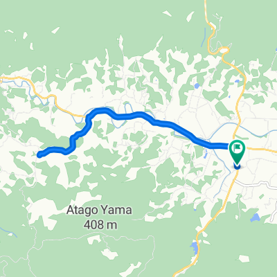
 BR-Minaminosato-HamaKanaya
- Distance
- 29.5 km
- Ascent
- 551 m
- Descent
- 595 m
- Location
- Kamogawa, Chiba, Japan
 Boso S3: Awa Kamogawa - Heguri - Hota
- Distance
- 61.4 km
- Ascent
- 371 m
- Descent
- 372 m
- Location
- Kamogawa, Chiba, Japan
 BR-EW-Kamogawa-Hota
- Distance
- 27.5 km
- Ascent
- 235 m
- Descent
- 233 m
- Location
- Kamogawa, Chiba, Japan
 Boso S3: Awa Kamogawa - Kanaya
- Distance
- 92.7 km
- Ascent
- 218 m
- Descent
- 220 m
- Location
- Kamogawa, Chiba, Japan
 BR-OyamaSenmaida-Return
- Distance
- 10 km
- Ascent
- 166 m
- Descent
- 167 m
- Location
- Kamogawa, Chiba, Japan
 安房鴨川コース(ロングコース)
- Distance
- 81.1 km
- Ascent
- 1,088 m
- Descent
- 1,086 m
- Location
- Kamogawa, Chiba, Japan
 Boso S3: Awa Kamogawa - Tateyama
- Distance
- 66.9 km
- Ascent
- 165 m
- Descent
- 170 m
- Location
- Kamogawa, Chiba, Japan
 BAC-AwaKamogawa-BnH
- Distance
- 45.2 km
- Ascent
- 481 m
- Descent
- 481 m
- Location
- Kamogawa, Chiba, Japan
Open it in the app