

Mainz-》 Frechen
A cycling route starting in Ludwigshöhe, Rhineland-Palatinate, Germany.
Overview
About this route
- 119 h 14 min
- Duration
- 453.7 km
- Distance
- 1,257 m
- Ascent
- 1,186 m
- Descent
- 3.8 km/h
- Avg. speed
- 159 m
- Max. altitude
Continue with Bikemap
Use, edit, or download this cycling route
You would like to ride Mainz-》 Frechen or customize it for your own trip? Here is what you can do with this Bikemap route:
Free features
- Save this route as favorite or in collections
- Copy & plan your own version of this route
- Split it into stages to create a multi-day tour
- Sync your route with Garmin or Wahoo
Premium features
Free trial for 3 days, or one-time payment. More about Bikemap Premium.
- Navigate this route on iOS & Android
- Export a GPX / KML file of this route
- Create your custom printout (try it for free)
- Download this route for offline navigation
Discover more Premium features.
Get Bikemap PremiumFrom our community
Other popular routes starting in Ludwigshöhe
 Radtour am 9. Juni 2020
- Distance
- 55.9 km
- Ascent
- 39 m
- Descent
- 35 m
- Location
- Ludwigshöhe, Rhineland-Palatinate, Germany
 K 41, Guntersblum nach Mainzer Straße 1–3, Nierstein
- Distance
- 9.2 km
- Ascent
- 106 m
- Descent
- 194 m
- Location
- Ludwigshöhe, Rhineland-Palatinate, Germany
 Kornsand-Kühkopf-Knoblochsaue
- Distance
- 19.7 km
- Ascent
- 75 m
- Descent
- 74 m
- Location
- Ludwigshöhe, Rhineland-Palatinate, Germany
 Straße ohne Straßennamen, Guntersblum nach Bleiche 2, Bingen am Rhein
- Distance
- 60.8 km
- Ascent
- 37 m
- Descent
- 46 m
- Location
- Ludwigshöhe, Rhineland-Palatinate, Germany
 B9, Ludwigshöhe nach Gimbsheimer Straße 46, Guntersblum
- Distance
- 6.9 km
- Ascent
- 89 m
- Descent
- 87 m
- Location
- Ludwigshöhe, Rhineland-Palatinate, Germany
 Route nach Hauptstraße, Eimsheim
- Distance
- 7.1 km
- Ascent
- 83 m
- Descent
- 36 m
- Location
- Ludwigshöhe, Rhineland-Palatinate, Germany
 Mainz-》 Frechen
- Distance
- 453.7 km
- Ascent
- 1,257 m
- Descent
- 1,186 m
- Location
- Ludwigshöhe, Rhineland-Palatinate, Germany
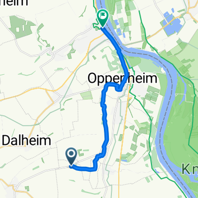
 Ludwigshöhe nach Fritz-Rüffer-Straße, Oppenheim
- Distance
- 21.3 km
- Ascent
- 22 m
- Descent
- 23 m
- Location
- Ludwigshöhe, Rhineland-Palatinate, Germany
Open it in the app