

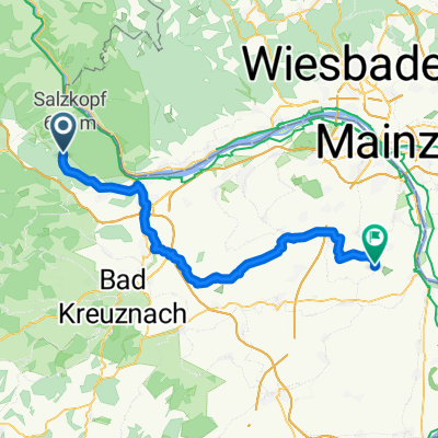
Lauschhütte Mommenheim
A cycling route starting in Oberheimbach, Rhineland-Palatinate, Germany.
Overview
About this route
- -:--
- Duration
- 58.6 km
- Distance
- 362 m
- Ascent
- 788 m
- Descent
- ---
- Avg. speed
- 580 m
- Max. altitude

Route quality
Waytypes & surfaces along the route
Waytypes
Track
23.5 km
(40 %)
Quiet road
15.6 km
(27 %)
Surfaces
Paved
45.3 km
(77 %)
Unpaved
4.4 km
(8 %)
Asphalt
29.3 km
(50 %)
Paved (undefined)
12.8 km
(22 %)
Continue with Bikemap
Use, edit, or download this cycling route
You would like to ride Lauschhütte Mommenheim or customize it for your own trip? Here is what you can do with this Bikemap route:
Free features
- Save this route as favorite or in collections
- Copy & plan your own version of this route
- Sync your route with Garmin or Wahoo
Premium features
Free trial for 3 days, or one-time payment. More about Bikemap Premium.
- Navigate this route on iOS & Android
- Export a GPX / KML file of this route
- Create your custom printout (try it for free)
- Download this route for offline navigation
Discover more Premium features.
Get Bikemap PremiumFrom our community
Other popular routes starting in Oberheimbach
 Lauschhütte Mommenheim
- Distance
- 58.6 km
- Ascent
- 362 m
- Descent
- 788 m
- Location
- Oberheimbach, Rhineland-Palatinate, Germany
 Rüdesheim Samstag 2
- Distance
- 19.7 km
- Ascent
- 249 m
- Descent
- 764 m
- Location
- Oberheimbach, Rhineland-Palatinate, Germany
 Forsthaus Lauschhütte 0, Weiler bei Bingen nach Am Heiligenhäuschen 4, Waldalgesheim
- Distance
- 10.4 km
- Ascent
- 116 m
- Descent
- 399 m
- Location
- Oberheimbach, Rhineland-Palatinate, Germany
 Schwachsinn
- Distance
- 3.5 km
- Ascent
- 185 m
- Descent
- 127 m
- Location
- Oberheimbach, Rhineland-Palatinate, Germany
 Hauptstraße 43, Oberheimbach nach Taunusstraße 11, Eltville am Rhein
- Distance
- 33.2 km
- Ascent
- 265 m
- Descent
- 321 m
- Location
- Oberheimbach, Rhineland-Palatinate, Germany
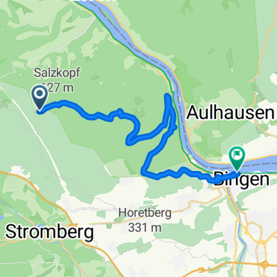
 Salzkopf7,5-460
- Distance
- 7.5 km
- Ascent
- 493 m
- Descent
- 55 m
- Location
- Oberheimbach, Rhineland-Palatinate, Germany
 Salzkopf
- Distance
- 4.9 km
- Ascent
- 442 m
- Descent
- 8 m
- Location
- Oberheimbach, Rhineland-Palatinate, Germany
 Gravel Oberheimbach 50km 1200hm
- Distance
- 50.8 km
- Ascent
- 1,259 m
- Descent
- 1,261 m
- Location
- Oberheimbach, Rhineland-Palatinate, Germany
Open it in the app