

DAg 4 Veloroute
A cycling route starting in Oberbillig, Rhineland-Palatinate, Germany.
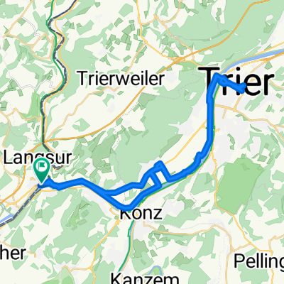
Overview
About this route
- -:--
- Duration
- 86 km
- Distance
- 93 m
- Ascent
- 66 m
- Descent
- ---
- Avg. speed
- ---
- Max. altitude

Route quality
Waytypes & surfaces along the route
Waytypes
Path
36.1 km
(42 %)
Access road
18.1 km
(21 %)
Surfaces
Paved
66.3 km
(77 %)
Unpaved
1.7 km
(2 %)
Asphalt
51.6 km
(60 %)
Paved (undefined)
11.2 km
(13 %)
Continue with Bikemap
Use, edit, or download this cycling route
You would like to ride DAg 4 Veloroute or customize it for your own trip? Here is what you can do with this Bikemap route:
Free features
- Save this route as favorite or in collections
- Copy & plan your own version of this route
- Split it into stages to create a multi-day tour
- Sync your route with Garmin or Wahoo
Premium features
Free trial for 3 days, or one-time payment. More about Bikemap Premium.
- Navigate this route on iOS & Android
- Export a GPX / KML file of this route
- Create your custom printout (try it for free)
- Download this route for offline navigation
Discover more Premium features.
Get Bikemap PremiumFrom our community
Other popular routes starting in Oberbillig
 1. dzień Niemcy, k. Trier - Luksemburg (Dippach)
- Distance
- 52.7 km
- Ascent
- 530 m
- Descent
- 304 m
- Location
- Oberbillig, Rhineland-Palatinate, Germany
 4.7. Kyll-Sauer
- Distance
- 65.2 km
- Ascent
- 485 m
- Descent
- 485 m
- Location
- Oberbillig, Rhineland-Palatinate, Germany
 rit oberbillig 13 september 2014
- Distance
- 99.4 km
- Ascent
- 773 m
- Descent
- 768 m
- Location
- Oberbillig, Rhineland-Palatinate, Germany
 3.7. Mosel
- Distance
- 87.3 km
- Ascent
- 71 m
- Descent
- 73 m
- Location
- Oberbillig, Rhineland-Palatinate, Germany
 Wasserbillig - Mittelmeer
- Distance
- 1,158.9 km
- Ascent
- 2,552 m
- Descent
- 2,674 m
- Location
- Oberbillig, Rhineland-Palatinate, Germany
 Oberbillig Cycling
- Distance
- 33.7 km
- Ascent
- 440 m
- Descent
- 442 m
- Location
- Oberbillig, Rhineland-Palatinate, Germany
 Wasserbilling - Trier
- Distance
- 38.7 km
- Ascent
- 118 m
- Descent
- 118 m
- Location
- Oberbillig, Rhineland-Palatinate, Germany
 Sauerrundtour Wasserbillig-Echternach
- Distance
- 49.4 km
- Ascent
- 483 m
- Descent
- 478 m
- Location
- Oberbillig, Rhineland-Palatinate, Germany
Open it in the app