

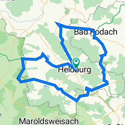
Heldburg-Seßlach
A cycling route starting in Hellingen, Thuringia, Germany.
Overview
About this route
- -:--
- Duration
- 16.2 km
- Distance
- 58 m
- Ascent
- 80 m
- Descent
- ---
- Avg. speed
- ---
- Max. altitude

Route quality
Waytypes & surfaces along the route
Waytypes
Path
3.9 km
(24 %)
Quiet road
3.1 km
(19 %)
Surfaces
Paved
12.6 km
(78 %)
Unpaved
3.1 km
(19 %)
Asphalt
10 km
(62 %)
Gravel
3.1 km
(19 %)
Continue with Bikemap
Use, edit, or download this cycling route
You would like to ride Heldburg-Seßlach or customize it for your own trip? Here is what you can do with this Bikemap route:
Free features
- Save this route as favorite or in collections
- Copy & plan your own version of this route
- Sync your route with Garmin or Wahoo
Premium features
Free trial for 3 days, or one-time payment. More about Bikemap Premium.
- Navigate this route on iOS & Android
- Export a GPX / KML file of this route
- Create your custom printout (try it for free)
- Download this route for offline navigation
Discover more Premium features.
Get Bikemap PremiumFrom our community
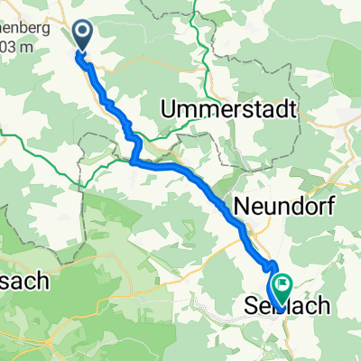
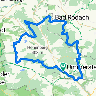
Other popular routes starting in Hellingen
 3.Tag Heldburg
- Distance
- 67.8 km
- Ascent
- 593 m
- Descent
- 592 m
- Location
- Hellingen, Thuringia, Germany
 Heldburg-Seßlach
- Distance
- 16.2 km
- Ascent
- 58 m
- Descent
- 80 m
- Location
- Hellingen, Thuringia, Germany
 Rainbrünnlein, Heldburg nach Luitpoldstraße, Seßlach
- Distance
- 16.8 km
- Ascent
- 53 m
- Descent
- 66 m
- Location
- Hellingen, Thuringia, Germany
 Hassberge Ren
- Distance
- 61.5 km
- Ascent
- 576 m
- Descent
- 544 m
- Location
- Hellingen, Thuringia, Germany
 Bad Colberg-Heldburg-Bad Rodach
- Distance
- 12.9 km
- Ascent
- 192 m
- Descent
- 175 m
- Location
- Hellingen, Thuringia, Germany
 Rieth Stausee - Altenfelden - Nonnreit 250
- Distance
- 154 km
- Ascent
- 334 m
- Descent
- 258 m
- Location
- Hellingen, Thuringia, Germany
 "Freunde der Bergfahrt" - Tour
- Distance
- 18.4 km
- Ascent
- 214 m
- Descent
- 214 m
- Location
- Hellingen, Thuringia, Germany
 Straufhain MTB
- Distance
- 55.4 km
- Ascent
- 627 m
- Descent
- 580 m
- Location
- Hellingen, Thuringia, Germany
Open it in the app