

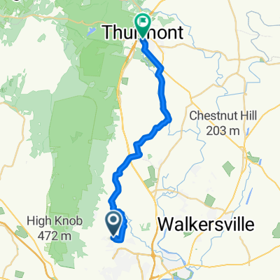
WTF was I thinking but it was fun
A cycling route starting in Clover Hill, Maryland, United States.
Overview
About this route
- 2 h 33 min
- Duration
- 40.3 km
- Distance
- 722 m
- Ascent
- 733 m
- Descent
- 15.8 km/h
- Avg. speed
- ---
- Max. altitude

Route photos

Route quality
Waytypes & surfaces along the route
Waytypes
Road
27 km
(67 %)
Quiet road
12.9 km
(32 %)
Access road
0.4 km
(1 %)
Surfaces
Paved
19.3 km
(48 %)
Asphalt
12.9 km
(32 %)
Paved (undefined)
6.4 km
(16 %)
Undefined
20.9 km
(52 %)
Continue with Bikemap
Use, edit, or download this cycling route
You would like to ride WTF was I thinking but it was fun or customize it for your own trip? Here is what you can do with this Bikemap route:
Free features
- Save this route as favorite or in collections
- Copy & plan your own version of this route
- Sync your route with Garmin or Wahoo
Premium features
Free trial for 3 days, or one-time payment. More about Bikemap Premium.
- Navigate this route on iOS & Android
- Export a GPX / KML file of this route
- Create your custom printout (try it for free)
- Download this route for offline navigation
Discover more Premium features.
Get Bikemap PremiumFrom our community
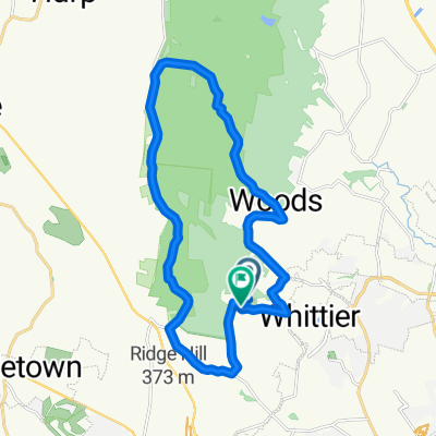
Other popular routes starting in Clover Hill
 Mountain Ride - Home
- Distance
- 10 km
- Ascent
- 176 m
- Descent
- 176 m
- Location
- Clover Hill, Maryland, United States
 Mountain Goal
- Distance
- 24 km
- Ascent
- 509 m
- Descent
- 500 m
- Location
- Clover Hill, Maryland, United States
 From Frederick to Thurmont
- Distance
- 22.5 km
- Ascent
- 143 m
- Descent
- 128 m
- Location
- Clover Hill, Maryland, United States
 Putt Puttin’ north of town
- Distance
- 26.2 km
- Ascent
- 340 m
- Descent
- 330 m
- Location
- Clover Hill, Maryland, United States
 Edgewood through Gambrill
- Distance
- 23.9 km
- Ascent
- 504 m
- Descent
- 517 m
- Location
- Clover Hill, Maryland, United States
 OMG WTF
- Distance
- 109.4 km
- Ascent
- 1,421 m
- Descent
- 1,424 m
- Location
- Clover Hill, Maryland, United States
 300 Cormorant Pl, Frederick to 416–424 Carroll Pkwy, Frederick
- Distance
- 5.7 km
- Ascent
- 27 m
- Descent
- 24 m
- Location
- Clover Hill, Maryland, United States
 Southern Frederick County Loop
- Distance
- 65.3 km
- Ascent
- 541 m
- Descent
- 541 m
- Location
- Clover Hill, Maryland, United States
Open it in the app