

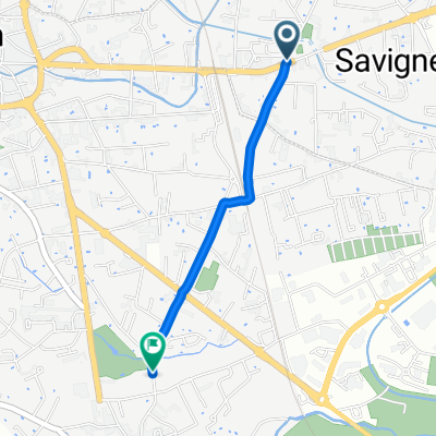
Jakobsweg Etappe 6 Montbrison - Le Puy
A cycling route starting in Savigneux, Auvergne-Rhône-Alpes, France.
Overview
About this route
- -:--
- Duration
- 99.9 km
- Distance
- 1,044 m
- Ascent
- 805 m
- Descent
- ---
- Avg. speed
- ---
- Max. altitude
Route quality
Waytypes & surfaces along the route
Waytypes
Busy road
65.6 km
(66 %)
Road
18.3 km
(18 %)
Surfaces
Paved
34.4 km
(34 %)
Unpaved
0.2 km
(<1 %)
Asphalt
34.4 km
(34 %)
Gravel
0.1 km
(<1 %)
Route highlights
Points of interest along the route
Point of interest after 1.4 km
Camping municipal
Point of interest after 6.4 km
JW
Point of interest after 38.1 km
JW
Point of interest after 85.2 km
JW
Point of interest after 99.1 km
Camping Municipale Bouthezard-AIGUILHE
Continue with Bikemap
Use, edit, or download this cycling route
You would like to ride Jakobsweg Etappe 6 Montbrison - Le Puy or customize it for your own trip? Here is what you can do with this Bikemap route:
Free features
- Save this route as favorite or in collections
- Copy & plan your own version of this route
- Split it into stages to create a multi-day tour
- Sync your route with Garmin or Wahoo
Premium features
Free trial for 3 days, or one-time payment. More about Bikemap Premium.
- Navigate this route on iOS & Android
- Export a GPX / KML file of this route
- Create your custom printout (try it for free)
- Download this route for offline navigation
Discover more Premium features.
Get Bikemap PremiumFrom our community
Other popular routes starting in Savigneux
 110 Jacob Charlieu - Mont brison
- Distance
- 67.6 km
- Ascent
- 373 m
- Descent
- 474 m
- Location
- Savigneux, Auvergne-Rhône-Alpes, France
 Caffee Late czyli Z Montbrison do Thiers.
- Distance
- 67.9 km
- Ascent
- 805 m
- Descent
- 743 m
- Location
- Savigneux, Auvergne-Rhône-Alpes, France
 4) Montbrison - Puy Chopine
- Distance
- 200.3 km
- Ascent
- 3,137 m
- Descent
- 2,507 m
- Location
- Savigneux, Auvergne-Rhône-Alpes, France
 Jakobsweg Etappe 6 Montbrison - Le Puy
- Distance
- 99.9 km
- Ascent
- 1,044 m
- Descent
- 805 m
- Location
- Savigneux, Auvergne-Rhône-Alpes, France
 2016.05.08-10 Montbrison - Ambert - Le Puy
- Distance
- 168.5 km
- Ascent
- 2,290 m
- Descent
- 2,041 m
- Location
- Savigneux, Auvergne-Rhône-Alpes, France
 Rue Bayard, Savigneux à Rue Centrale, Montbrison
- Distance
- 1.9 km
- Ascent
- 19 m
- Descent
- 6 m
- Location
- Savigneux, Auvergne-Rhône-Alpes, France
 Montbrison-Belley
- Distance
- 172.5 km
- Ascent
- 877 m
- Descent
- 982 m
- Location
- Savigneux, Auvergne-Rhône-Alpes, France
 Montbrison - Saint-Étienne (Circuit)
- Distance
- 158.8 km
- Ascent
- 2,567 m
- Descent
- 2,350 m
- Location
- Savigneux, Auvergne-Rhône-Alpes, France
Open it in the app