4754 Upton to Lake City
A cycling route starting in Edina, Minnesota, United States of America.
Overview
About this route
First leg of our 2010 bike tour, en route to SAGBRAW
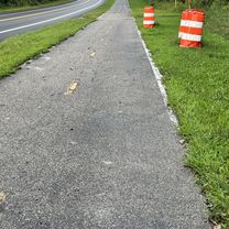
West 160th Street through Rosemount is gravel, and rather slow going. It is to be paved as the University of Minnesota establishes a more active presence, so may be nice, fresh pavement in 2011.
The segment of 145th that is the continuation of Ravenna Trail (just noth of Highway 61) was for much of its length unpaved; it was rough going for a tour-loaded tandem trike, and might be all but impassable after a rainstorm. The Cannon Valley Trail segment (Welch to Red Wing) requires a trail pass, but is paved and quite pretty. Highway 61 is moderately busy, but has a good, wide shoulder.
- -:--
- Duration
- 127.2 km
- Distance
- 275 m
- Ascent
- 326 m
- Descent
- ---
- Avg. speed
- ---
- Avg. speed
Continue with Bikemap
Use, edit, or download this cycling route
You would like to ride 4754 Upton to Lake City or customize it for your own trip? Here is what you can do with this Bikemap route:
Free features
- Save this route as favorite or in collections
- Copy & plan your own version of this route
- Sync your route with Garmin or Wahoo
Premium features
Free trial for 3 days, or one-time payment. More about Bikemap Premium.
- Navigate this route on iOS & Android
- Export a GPX / KML file of this route
- Create your custom printout (try it for free)
- Download this route for offline navigation
Discover more Premium features.
Get Bikemap PremiumFrom our community
Other popular routes starting in Edina
- Sept 9 2012 Century Ride
- Distance
- 161.2 km
- Ascent
- 334 m
- Descent
- 334 m
- Location
- Edina, Minnesota, United States of America
- Usual Commute, updated May 2013
- Distance
- 16.2 km
- Ascent
- 100 m
- Descent
- 107 m
- Location
- Edina, Minnesota, United States of America
- Lake Harriet - Calhoun - Greenway - River - Creek
- Distance
- 28.6 km
- Ascent
- 90 m
- Descent
- 96 m
- Location
- Edina, Minnesota, United States of America
- Commute Via Creek
- Distance
- 18.3 km
- Ascent
- 107 m
- Descent
- 116 m
- Location
- Edina, Minnesota, United States of America
- via Midtown Greenway, Park Ave
- Distance
- 13.8 km
- Ascent
- 30 m
- Descent
- 35 m
- Location
- Edina, Minnesota, United States of America
- Open Streets Jul 23 2017
- Distance
- 27.8 km
- Ascent
- 76 m
- Descent
- 76 m
- Location
- Edina, Minnesota, United States of America
- Minn River/Hyland Preserve
- Distance
- 33.1 km
- Ascent
- 175 m
- Descent
- 195 m
- Location
- Edina, Minnesota, United States of America
- 4754 Upton to Lake City
- Distance
- 127.2 km
- Ascent
- 275 m
- Descent
- 326 m
- Location
- Edina, Minnesota, United States of America
Open it in the app