mattumpu-batu menbalo-ellue-s. tangka
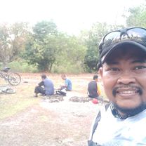
A cycling route starting in Sinjai, South Sulawesi, Indonesia.
Overview
About this route
- 1 h 1 min
- Duration
- 10.2 km
- Distance
- 166 m
- Ascent
- 138 m
- Descent
- 10 km/h
- Avg. speed
- ---
- Avg. speed
Route photos
Route quality
Waytypes & surfaces along the route
Waytypes
Undefined
10.2 km
(100 %)
Surfaces
Undefined
10.2 km
(100 %)
Continue with Bikemap
Use, edit, or download this cycling route
You would like to ride mattumpu-batu menbalo-ellue-s. tangka or customize it for your own trip? Here is what you can do with this Bikemap route:
Free features
- Save this route as favorite or in collections
- Copy & plan your own version of this route
- Sync your route with Garmin or Wahoo
Premium features
Free trial for 3 days, or one-time payment. More about Bikemap Premium.
- Navigate this route on iOS & Android
- Export a GPX / KML file of this route
- Create your custom printout (try it for free)
- Download this route for offline navigation
Discover more Premium features.
Get Bikemap PremiumFrom our community
Other popular routes starting in Sinjai
- mattumpu panreng
- Distance
- 11.1 km
- Ascent
- 516 m
- Descent
- 509 m
- Location
- Sinjai, South Sulawesi, Indonesia
- tanassang-jelajah-lap bersatu-gojeng
- Distance
- 10.9 km
- Ascent
- 716 m
- Descent
- 724 m
- Location
- Sinjai, South Sulawesi, Indonesia
- jelaja-panreng-lita-btn tangka mas
- Distance
- 12.4 km
- Ascent
- 668 m
- Descent
- 665 m
- Location
- Sinjai, South Sulawesi, Indonesia
- Jalan Bulu Manyurung, Sinjai Utara to Jalan Ranggong Dg. Romo 60, Sinjai Utara
- Distance
- 11.5 km
- Ascent
- 145 m
- Descent
- 145 m
- Location
- Sinjai, South Sulawesi, Indonesia
- jelajah2-panreng-tanassang-jelajah 1-kota
- Distance
- 14.6 km
- Ascent
- 555 m
- Descent
- 559 m
- Location
- Sinjai, South Sulawesi, Indonesia
- bonto-jelajah1
- Distance
- 15.4 km
- Ascent
- 721 m
- Descent
- 722 m
- Location
- Sinjai, South Sulawesi, Indonesia
- mattumpu-batu menbalo-ellue-s. tangka
- Distance
- 10.2 km
- Ascent
- 166 m
- Descent
- 138 m
- Location
- Sinjai, South Sulawesi, Indonesia
- Jalan Sungai Tangka 87, Sinjai Utara to Jalan Sungai Tangka 87, Sinjai Utara
- Distance
- 6.7 km
- Ascent
- 0 m
- Descent
- 3 m
- Location
- Sinjai, South Sulawesi, Indonesia