

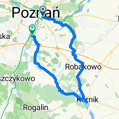
63.2 km route
A cycling route starting in Poznan, Greater Poland Voivodeship, Poland.
Overview
About this route
- -:--
- Duration
- 64.3 km
- Distance
- 63 m
- Ascent
- 66 m
- Descent
- ---
- Avg. speed
- ---
- Max. altitude

Route quality
Waytypes & surfaces along the route
Waytypes
Road
28.9 km
(45 %)
Quiet road
14.1 km
(22 %)
Surfaces
Paved
51.4 km
(80 %)
Unpaved
2.6 km
(4 %)
Asphalt
48.8 km
(76 %)
Paved (undefined)
2.6 km
(4 %)
Continue with Bikemap
Use, edit, or download this cycling route
You would like to ride 63.2 km route or customize it for your own trip? Here is what you can do with this Bikemap route:
Free features
- Save this route as favorite or in collections
- Copy & plan your own version of this route
- Sync your route with Garmin or Wahoo
Premium features
Free trial for 3 days, or one-time payment. More about Bikemap Premium.
- Navigate this route on iOS & Android
- Export a GPX / KML file of this route
- Create your custom printout (try it for free)
- Download this route for offline navigation
Discover more Premium features.
Get Bikemap PremiumFrom our community
Other popular routes starting in Poznan
 Lasek Marceliński
- Distance
- 16.1 km
- Ascent
- 30 m
- Descent
- 31 m
- Location
- Poznan, Greater Poland Voivodeship, Poland
 POZNAŃ centrum - Jez, Maltańskie - Darzybór - Spławie - Krzesiny, Spyniewo - Głuszyna - Marlewo - Poznań Centrum
- Distance
- 40.8 km
- Ascent
- 77 m
- Descent
- 77 m
- Location
- Poznan, Greater Poland Voivodeship, Poland
 Wronczyn
- Distance
- 55.6 km
- Ascent
- 176 m
- Descent
- 176 m
- Location
- Poznan, Greater Poland Voivodeship, Poland
 Poznań Rataje Mosina j.góreckie Puszczykowo poznań
- Distance
- 53.9 km
- Ascent
- 136 m
- Descent
- 137 m
- Location
- Poznan, Greater Poland Voivodeship, Poland
 Przez Różany potok-morasko-poligon biedrusko
- Distance
- 30.1 km
- Ascent
- 109 m
- Descent
- 111 m
- Location
- Poznan, Greater Poland Voivodeship, Poland
 Coffee ride do Kórnika
- Distance
- 50.1 km
- Ascent
- 205 m
- Descent
- 204 m
- Location
- Poznan, Greater Poland Voivodeship, Poland
 AC-Promno-AC
- Distance
- 59.4 km
- Ascent
- 153 m
- Descent
- 154 m
- Location
- Poznan, Greater Poland Voivodeship, Poland
 Poznań - Puszczykowo
- Distance
- 13.8 km
- Ascent
- 41 m
- Descent
- 32 m
- Location
- Poznan, Greater Poland Voivodeship, Poland
Open it in the app