

Abwandern zum Schloss Molsdorf
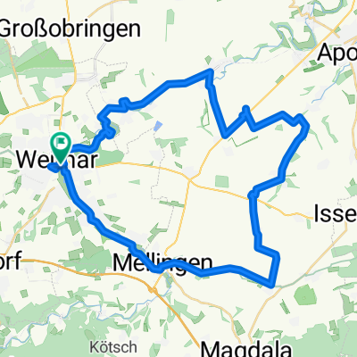
A cycling route starting in Weimar, Thuringia, Germany.
Overview
About this route
Bis Schloss Molsdorf sind es 47 km mit 380 Hm. Dort ist eine schöne Möglichkeit zur Rast!
- -:--
- Duration
- 95 km
- Distance
- 617 m
- Ascent
- 615 m
- Descent
- ---
- Avg. speed
- ---
- Max. altitude

Route quality
Waytypes & surfaces along the route
Waytypes
Road
54.1 km
(57 %)
Quiet road
9.5 km
(10 %)
Surfaces
Paved
88.3 km
(93 %)
Unpaved
3.8 km
(4 %)
Asphalt
88.3 km
(93 %)
Gravel
1.9 km
(2 %)
Continue with Bikemap
Use, edit, or download this cycling route
You would like to ride Abwandern zum Schloss Molsdorf or customize it for your own trip? Here is what you can do with this Bikemap route:
Free features
- Save this route as favorite or in collections
- Copy & plan your own version of this route
- Split it into stages to create a multi-day tour
- Sync your route with Garmin or Wahoo
Premium features
Free trial for 3 days, or one-time payment. More about Bikemap Premium.
- Navigate this route on iOS & Android
- Export a GPX / KML file of this route
- Create your custom printout (try it for free)
- Download this route for offline navigation
Discover more Premium features.
Get Bikemap PremiumFrom our community
Other popular routes starting in Weimar
 13.04.10 Weimar-Köttendorf-Bad Berka Waldstrecke
- Distance
- 33.1 km
- Ascent
- 453 m
- Descent
- 417 m
- Location
- Weimar, Thuringia, Germany
 Sonntagsschwitz
- Distance
- 47.7 km
- Ascent
- 588 m
- Descent
- 587 m
- Location
- Weimar, Thuringia, Germany
 Weimar Idee 2
- Distance
- 36.1 km
- Ascent
- 425 m
- Descent
- 426 m
- Location
- Weimar, Thuringia, Germany
 Rundtour um Weimar
- Distance
- 41.2 km
- Ascent
- 241 m
- Descent
- 249 m
- Location
- Weimar, Thuringia, Germany
 Ilmtalwanderweg
- Distance
- 59.4 km
- Ascent
- 432 m
- Descent
- 170 m
- Location
- Weimar, Thuringia, Germany
 RR 70 km Weimar - Erfurt - Riechheim - Bad Berka
- Distance
- 71.7 km
- Ascent
- 641 m
- Descent
- 641 m
- Location
- Weimar, Thuringia, Germany
 06.04.10 Jena-Tour mit Flo+Seb
- Distance
- 57 km
- Ascent
- 862 m
- Descent
- 819 m
- Location
- Weimar, Thuringia, Germany
 Feierabendrunde Weimar Nord/West
- Distance
- 36.9 km
- Ascent
- 463 m
- Descent
- 438 m
- Location
- Weimar, Thuringia, Germany
Open it in the app