

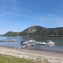
2019 08 30 OKT Szendehely - Felsőpetény
A cycling route starting in Verőce, Pest County, Hungary.
Overview
About this route
- -:--
- Duration
- 22.4 km
- Distance
- 1,303 m
- Ascent
- 1,357 m
- Descent
- ---
- Avg. speed
- ---
- Max. altitude
Continue with Bikemap
Use, edit, or download this cycling route
You would like to ride 2019 08 30 OKT Szendehely - Felsőpetény or customize it for your own trip? Here is what you can do with this Bikemap route:
Free features
- Save this route as favorite or in collections
- Copy & plan your own version of this route
- Sync your route with Garmin or Wahoo
Premium features
Free trial for 3 days, or one-time payment. More about Bikemap Premium.
- Navigate this route on iOS & Android
- Export a GPX / KML file of this route
- Create your custom printout (try it for free)
- Download this route for offline navigation
Discover more Premium features.
Get Bikemap PremiumFrom our community
Other popular routes starting in Verőce
 Árpád út - Árpád út
- Distance
- 30.3 km
- Ascent
- 106 m
- Descent
- 152 m
- Location
- Verőce, Pest County, Hungary
 Börzsöny1
- Distance
- 87 km
- Ascent
- 1,107 m
- Descent
- 1,104 m
- Location
- Verőce, Pest County, Hungary
 Borzsony nagykor
- Distance
- 96.7 km
- Ascent
- 534 m
- Descent
- 538 m
- Location
- Verőce, Pest County, Hungary
 Magas tátra túra
- Distance
- 224.9 km
- Ascent
- 1,582 m
- Descent
- 1,241 m
- Location
- Verőce, Pest County, Hungary
 Dunakanyar-Börzsöny
- Distance
- 57 km
- Ascent
- 366 m
- Descent
- 366 m
- Location
- Verőce, Pest County, Hungary
 Börzsöny kis kör
- Distance
- 89.4 km
- Ascent
- 582 m
- Descent
- 602 m
- Location
- Verőce, Pest County, Hungary
 Verőce Gravel kör
- Distance
- 18.6 km
- Ascent
- 224 m
- Descent
- 225 m
- Location
- Verőce, Pest County, Hungary
 Magyarkut-Diosjeno-Foltankereszt-Kiralyret
- Distance
- 40.2 km
- Ascent
- 756 m
- Descent
- 755 m
- Location
- Verőce, Pest County, Hungary
Open it in the app