

gowes sore
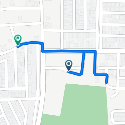
A cycling route starting in Talangbetutu, South Sumatra, Indonesia.
Overview
About this route
- 1 h 27 min
- Duration
- 14.9 km
- Distance
- 162 m
- Ascent
- 165 m
- Descent
- 10.3 km/h
- Avg. speed
- ---
- Max. altitude

Route photos


Route quality
Waytypes & surfaces along the route
Waytypes
Quiet road
5.9 km
(40 %)
Road
5.4 km
(36 %)
Surfaces
Paved
1.2 km
(8 %)
Asphalt
1.2 km
(8 %)
Undefined
13.7 km
(92 %)
Continue with Bikemap
Use, edit, or download this cycling route
You would like to ride gowes sore or customize it for your own trip? Here is what you can do with this Bikemap route:
Free features
- Save this route as favorite or in collections
- Copy & plan your own version of this route
- Sync your route with Garmin or Wahoo
Premium features
Free trial for 3 days, or one-time payment. More about Bikemap Premium.
- Navigate this route on iOS & Android
- Export a GPX / KML file of this route
- Create your custom printout (try it for free)
- Download this route for offline navigation
Discover more Premium features.
Get Bikemap PremiumFrom our community
Other popular routes starting in Talangbetutu
 sepeda sore
- Distance
- 18.5 km
- Ascent
- 260 m
- Descent
- 266 m
- Location
- Talangbetutu, South Sumatra, Indonesia
 Jalan Rama 5, Sukarami to Jalan Elang Raya, Sukarami
- Distance
- 11.8 km
- Ascent
- 69 m
- Descent
- 72 m
- Location
- Talangbetutu, South Sumatra, Indonesia
 Jalan Lintas Sumatera, Kecamatan Talang Kelapa to Gang Amal No 577A, Kecamatan Kemuning
- Distance
- 11.7 km
- Ascent
- 87 m
- Descent
- 81 m
- Location
- Talangbetutu, South Sumatra, Indonesia
 gowes sore
- Distance
- 14.9 km
- Ascent
- 162 m
- Descent
- 165 m
- Location
- Talangbetutu, South Sumatra, Indonesia
 sepeda sore
- Distance
- 5.6 km
- Ascent
- 124 m
- Descent
- 127 m
- Location
- Talangbetutu, South Sumatra, Indonesia
 Jalan Hasanudin to Jalan Hasanudin
- Distance
- 1.1 km
- Ascent
- 17 m
- Descent
- 17 m
- Location
- Talangbetutu, South Sumatra, Indonesia
 jalan trans airbatu
- Distance
- 25.5 km
- Ascent
- 97 m
- Descent
- 104 m
- Location
- Talangbetutu, South Sumatra, Indonesia
 gowes dewean
- Distance
- 11.8 km
- Ascent
- 193 m
- Descent
- 165 m
- Location
- Talangbetutu, South Sumatra, Indonesia
Open it in the app