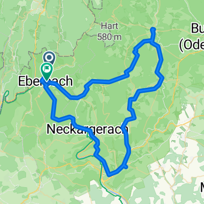
von Eberbach nach Höchst über die Odenwaldhöhen
A cycling route starting in Eberbach, Baden-Württemberg, Germany.
Overview
About this route
Einmal im Jahr ist diese Tour dran. Mit der Odenwaldbahn nach Eberbach und dann nach Höchst zurück über das Reußenkreuz, das Bullauer Bild, Würzberg, Vielbrunn, Toter Mann und die Rimhorner Höhe. Viele Höhenmeter und viel Odenwald. Genial. #noebike
- -:--
- Duration
- 55.1 km
- Distance
- 1,165 m
- Ascent
- 1,100 m
- Descent
- ---
- Avg. speed
- ---
- Avg. speed
Route photos
Route quality
Waytypes & surfaces along the route
Waytypes
Track
34.6 km
(63 %)
Quiet road
8.4 km
(15 %)
Surfaces
Paved
11.3 km
(20 %)
Unpaved
34 km
(62 %)
Gravel
21.1 km
(38 %)
Asphalt
9.5 km
(17 %)
Continue with Bikemap
Use, edit, or download this cycling route
You would like to ride von Eberbach nach Höchst über die Odenwaldhöhen or customize it for your own trip? Here is what you can do with this Bikemap route:
Free features
- Save this route as favorite or in collections
- Copy & plan your own version of this route
- Sync your route with Garmin or Wahoo
Premium features
Free trial for 3 days, or one-time payment. More about Bikemap Premium.
- Navigate this route on iOS & Android
- Export a GPX / KML file of this route
- Create your custom printout (try it for free)
- Download this route for offline navigation
Discover more Premium features.
Get Bikemap PremiumFrom our community
Other popular routes starting in Eberbach
- Eberbach- Heidelberg
- Distance
- 34 km
- Ascent
- 218 m
- Descent
- 231 m
- Location
- Eberbach, Baden-Württemberg, Germany
- 38_Eberbach – Heidelberg – Mannheim
- Distance
- 56.5 km
- Ascent
- 166 m
- Descent
- 205 m
- Location
- Eberbach, Baden-Württemberg, Germany
- Eberbacher Weg, Waldbrunn nach Eberbacher Weg, Waldbrunn
- Distance
- 13.5 km
- Ascent
- 884 m
- Descent
- 883 m
- Location
- Eberbach, Baden-Württemberg, Germany
- von Eberbach nach Höchst über die Odenwaldhöhen
- Distance
- 55.1 km
- Ascent
- 1,165 m
- Descent
- 1,100 m
- Location
- Eberbach, Baden-Württemberg, Germany
- Eberbach-Erlenbach-Michelstadt-ret
- Distance
- 128.8 km
- Ascent
- 1,031 m
- Descent
- 1,028 m
- Location
- Eberbach, Baden-Württemberg, Germany
- 6. Nordkap Eberbach - Kreuzwertheim
- Distance
- 79.6 km
- Ascent
- 1,099 m
- Descent
- 1,106 m
- Location
- Eberbach, Baden-Württemberg, Germany
- RSCN Am Limes entlang
- Distance
- 121.4 km
- Ascent
- 1,155 m
- Descent
- 1,157 m
- Location
- Eberbach, Baden-Württemberg, Germany
- Eberbach-Igelsbach-Hirschhorn rotesR-Eberbach
- Distance
- 23.4 km
- Ascent
- 370 m
- Descent
- 371 m
- Location
- Eberbach, Baden-Württemberg, Germany
Open it in the app