

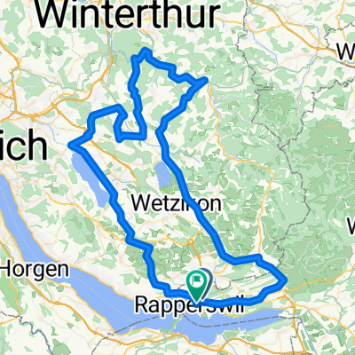
Toggenburg
A cycling route starting in Jona, Canton of St. Gallen, Switzerland.
Overview
About this route
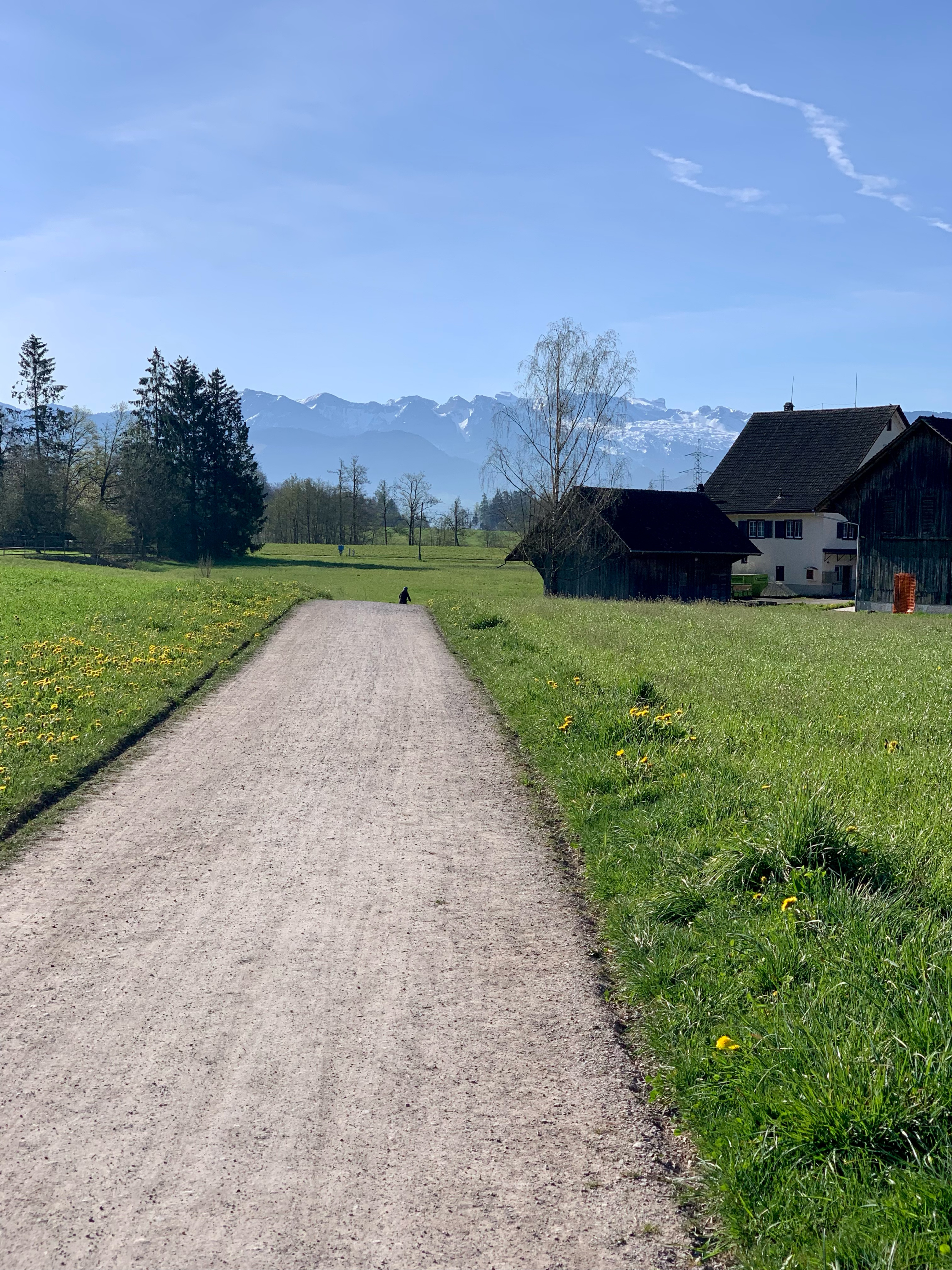
So langsam folgen die anspruchsvolleren Touren; ca. 120 km und etwa 1800 Hm warten auf uns durchs Toggenburg; Streckendetails sowie GPS-Daten im Anhang.
- -:--
- Duration
- 119.3 km
- Distance
- 1,424 m
- Ascent
- 1,423 m
- Descent
- ---
- Avg. speed
- ---
- Max. altitude

Route quality
Waytypes & surfaces along the route
Waytypes
Road
39.6 km
(33 %)
Quiet road
24.9 km
(21 %)
Surfaces
Paved
94.8 km
(79 %)
Unpaved
6.5 km
(5 %)
Asphalt
93.9 km
(79 %)
Gravel
2.2 km
(2 %)
Continue with Bikemap
Use, edit, or download this cycling route
You would like to ride Toggenburg or customize it for your own trip? Here is what you can do with this Bikemap route:
Free features
- Save this route as favorite or in collections
- Copy & plan your own version of this route
- Split it into stages to create a multi-day tour
- Sync your route with Garmin or Wahoo
Premium features
Free trial for 3 days, or one-time payment. More about Bikemap Premium.
- Navigate this route on iOS & Android
- Export a GPX / KML file of this route
- Create your custom printout (try it for free)
- Download this route for offline navigation
Discover more Premium features.
Get Bikemap PremiumFrom our community
Other popular routes starting in Jona
 Einmal meh über d'Sihl
- Distance
- 35.1 km
- Ascent
- 533 m
- Descent
- 530 m
- Location
- Jona, Canton of St. Gallen, Switzerland
 Sternenberg
- Distance
- 104.8 km
- Ascent
- 1,174 m
- Descent
- 1,173 m
- Location
- Jona, Canton of St. Gallen, Switzerland
 Buechstrasse 38, Jona SG nach Grämigerstrasse 1, Bütschwil
- Distance
- 48.9 km
- Ascent
- 1,168 m
- Descent
- 979 m
- Location
- Jona, Canton of St. Gallen, Switzerland
 Jona-Wald-Bachtel-Oberdürnten-Rüti-Jona
- Distance
- 30.6 km
- Ascent
- 765 m
- Descent
- 764 m
- Location
- Jona, Canton of St. Gallen, Switzerland
 7-Rapperswil-Mosnang_79km-1495Hm
- Distance
- 80.3 km
- Ascent
- 2,086 m
- Descent
- 1,764 m
- Location
- Jona, Canton of St. Gallen, Switzerland
 Jona-Eggwald-Goldingen-Laupen-Jona
- Distance
- 28.7 km
- Ascent
- 615 m
- Descent
- 489 m
- Location
- Jona, Canton of St. Gallen, Switzerland
 Toblerone
- Distance
- 19.1 km
- Ascent
- 253 m
- Descent
- 255 m
- Location
- Jona, Canton of St. Gallen, Switzerland
 Kyburg
- Distance
- 105 km
- Ascent
- 678 m
- Descent
- 680 m
- Location
- Jona, Canton of St. Gallen, Switzerland
Open it in the app