

Nancy – Blieskastel
A cycling route starting in Villers-lès-Nancy, Grand Est, France.
Overview
About this route
A fairly long and varied route that tries, as much as possible, to avoid the main roads. We leave Nancy via the greenway towards Amance / Brin sur Seille and then follow small country roads to reach Vic sur Seille. After a few kilometers on the main road, we turn towards Marsal and then reach Dieuze via Église Blanche. There we are obliged to follow the very busy D22, but we leave it just after crossing the TGV line to follow the D28. At Kapperkinger we take the beautiful bike path (in fact a small forest road) to reach the Saar canal, which itself has a bike path that we follow to Sarralbe and then Wittring. Upon leaving the canal, we turn left and follow an unmarked road, with a fairly steep climb, to arrive at Wiesviller. From there, we turn left (still without signs and with hills) to reach Bliesbruck. We cross the border at the Bliesbruck-Reinheim Archaeological Park, then follow the signs to reach Gersheim. From there, a beautiful greenway on an old railway line takes us to Blieskastel, with its center dating largely from the 18th century.
- -:--
- Duration
- 138.1 km
- Distance
- 777 m
- Ascent
- 792 m
- Descent
- ---
- Avg. speed
- ---
- Max. altitude
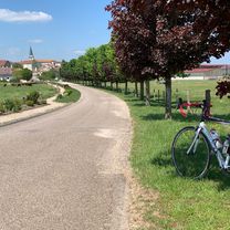
Route photos


Route quality
Waytypes & surfaces along the route
Waytypes
Road
41.4 km
(30 %)
Quiet road
23.5 km
(17 %)
Surfaces
Paved
105 km
(76 %)
Unpaved
4.1 km
(3 %)
Asphalt
92.5 km
(67 %)
Paved (undefined)
9.7 km
(7 %)
Continue with Bikemap
Use, edit, or download this cycling route
You would like to ride Nancy – Blieskastel or customize it for your own trip? Here is what you can do with this Bikemap route:
Free features
- Save this route as favorite or in collections
- Copy & plan your own version of this route
- Split it into stages to create a multi-day tour
- Sync your route with Garmin or Wahoo
Premium features
Free trial for 3 days, or one-time payment. More about Bikemap Premium.
- Navigate this route on iOS & Android
- Export a GPX / KML file of this route
- Create your custom printout (try it for free)
- Download this route for offline navigation
Discover more Premium features.
Get Bikemap PremiumFrom our community
Other popular routes starting in Villers-lès-Nancy
 Hattonchâtel
- Distance
- 79 km
- Ascent
- 456 m
- Descent
- 342 m
- Location
- Villers-lès-Nancy, Grand Est, France
 Côte de Toul - Gélaucourt
- Distance
- 101.9 km
- Ascent
- 1,050 m
- Descent
- 1,051 m
- Location
- Villers-lès-Nancy, Grand Est, France
 Étang de Lindre
- Distance
- 130.5 km
- Ascent
- 237 m
- Descent
- 237 m
- Location
- Villers-lès-Nancy, Grand Est, France
 Nancy - Bèze (Côte d’Or)
- Distance
- 243.1 km
- Ascent
- 1,631 m
- Descent
- 1,648 m
- Location
- Villers-lès-Nancy, Grand Est, France
 Bitche
- Distance
- 132.4 km
- Ascent
- 632 m
- Descent
- 545 m
- Location
- Villers-lès-Nancy, Grand Est, France
 Nancy – Blieskastel
- Distance
- 138.1 km
- Ascent
- 777 m
- Descent
- 792 m
- Location
- Villers-lès-Nancy, Grand Est, France
 Nancy - St. Mihiel
- Distance
- 77 km
- Ascent
- 532 m
- Descent
- 546 m
- Location
- Villers-lès-Nancy, Grand Est, France
 Un p’tit bout de Meuse
- Distance
- 129.3 km
- Ascent
- 1,337 m
- Descent
- 1,337 m
- Location
- Villers-lès-Nancy, Grand Est, France
Open it in the app